Articles posted by VertidroneTech

For small land surveying practices, boutique civil engineering consultancies, local construction firms, and specialized GIS agencies, allocating capital for hardware fleet upgrades is a pivotal financial decision. In the commercial aerial mapping industry, Real-Time Kinematic (RTK) positioning technology has shifted from an expensive niche capability to an essential benchmark for high-precision data collection. However, business …
Continue reading RTK Drone Economics for Small Teams: Investment ROI and Software Processing Guide
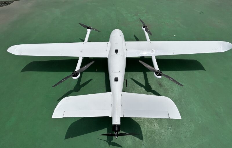
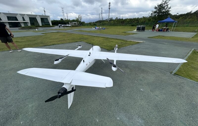
Managing large-scale earthwork moving, mining extraction, quarry inventory tracking, and civil construction grading requires absolute financial control over material quantities. Historically, stockpile measurements and cut-and-fill calculations relied on manual ground surveys utilizing total stations or GPS rover rods—a process prone to interpolation errors, severe safety risks around heavy machinery, and slow data delivery. The advent …
Continue reading Volumetric Drone Surveying: Accuracy Tolerances & Time Savings Analysis

Real-Time Kinematic (RTK) technology has fundamentally changed the land surveying, civil engineering, and aerial mapping industries by providing centimeter-level horizontal positioning in real time. Despite deploying advanced enterprise hardware, field teams frequently encounter unexpected vertical discrepancies in their 3D terrain models and elevation datasets. A digital elevation model (DEM) or point cloud may perfectly align …
Continue reading Troubleshooting Drone Surveys: Vertical Accuracy Errors and RTK Signal Loss

In high-precision commercial aerial mapping, land surveying, and civil engineering, Real-Time Kinematic (RTK) technology has transformed enterprise field workflows. By calculating differential satellite positioning corrections in real time, RTK drones capture georeferenced aerial imagery with centimeter-level horizontal and vertical precision. However, setting up a physical local GNSS base station—setting up heavy tripods, measuring antenna heights, …
Continue reading Understanding RTK Drone Operations: Local Base Stations vs. NTRIP Networks

Large-scale precision agriculture and long-range infrastructure engineering represent two of the most demanding operational domains for modern commercial UAV technology. Traditional ground sampling, manned satellite imaging, and standard multirotor drones often fail to balance coverage area, spatial resolution, and operational flexibility. Multirotor aircraft lack the battery endurance required to scan thousands of agricultural acres or …
Continue reading Enterprise UAV Applications: VTOL Drones for Agriculture & Corridor Surveying

Industrial land managers, environmental scientists, and energy utility executives face complex operational hurdles when mapping massive geographic expanses. Traditional manual forestry inventories and crewed helicopter corridor patrols are constrained by high labor costs, severe safety hazards, and slow data turnarounds. Overcoming these geographic bottlenecks requires adopting heavy-duty hybrid unmanned aerial vehicles (UAVs). Combining vertical takeoff …
Continue reading Enterprise UAV Guide: Best VTOL Drones for LiDAR Forestry Mapping & Pipeline Inspection

In the modern commercial landscape, the integration of unmanned aerial vehicle (UAV) technologies into day-to-day project workflows is no longer just an experimental novelty. It represents a fundamental shifting point in industrial data processing efficiency. Whether managing extensive mining projects, calculating raw material inventory tracking, or checking excavation progress on civil engineering jobs, organizations face …
Continue reading The ROI of Drone Surveying: Cost, Time Savings, and Software Compatibility

Deploying high-precision Real-Time Kinematic (RTK) drones for industrial surveying has drastically condensed corporate operational timelines. However, transitioning to an advanced drone mapping workflow requires navigating complex configurations that govern GNSS corrections. In commercial environments, field crews routinely encounter technical bottlenecks, such as fluctuating network linkages, subtle coordinate reference mismatches, and physical signal blocks. To maximize …
Continue reading Troubleshooting Drone RTK: NTRIP, Base Station Setup, and Accuracy Failures

Implementing high-precision geospatial data collection methods has revolutionized industries such as land development, open-pit mining, environmental forestry, and heavy infrastructure design. As commercial unmanned aerial vehicle (UAV) technologies advance, geospatial engineers must continuously evaluate different methods for capturing accurate, real-world coordinate structures. Achieving centimeter-level precision across a digital orthomosaic map or a three-dimensional point cloud …
Continue reading High-Accuracy Drone Mapping: RTK vs. PPK vs. GCPs Compared

Deploying commercial drones for geographic information systems (GIS), construction volumetric mapping, and civil engineering infrastructure surveys requires an absolute understanding of spatial data accuracy. In the modern drone mapping landscape, relying on basic positioning technology can compromise entire structural datasets, leading to expensive alignment errors and regulatory failures. To mitigate these precision risks, modern aerial …
Continue reading Drone Surveying Accuracy Guide: What is the Difference Between RTK and GPS?

Select the fields to be shown. Others will be hidden. Drag and drop to rearrange the order.
  • Image
  • SKU
  • Rating
  • Price
  • Stock
  • Availability
  • Add to cart
  • Description
  • Content
  • Weight
  • Dimensions
  • Additional information
Click outside to hide the comparison bar
Compare