No products in the cart.
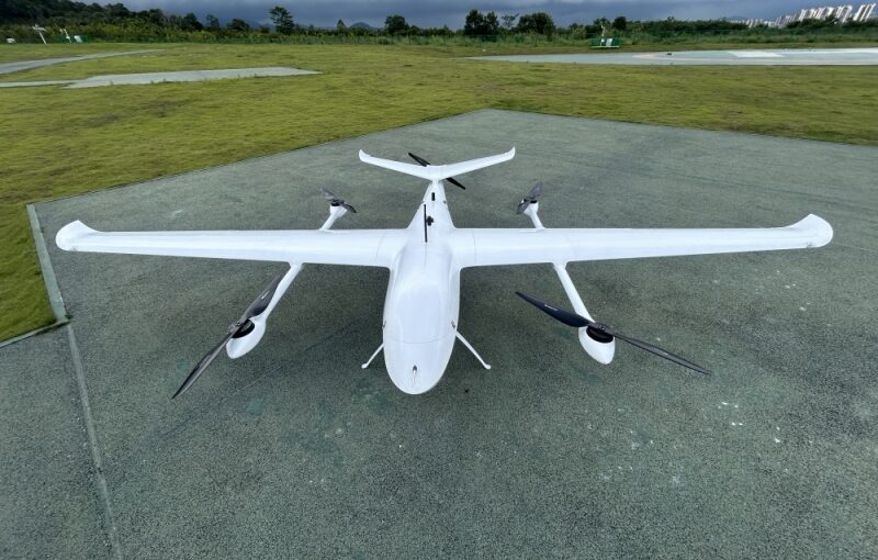
Deploying high-precision Real-Time Kinematic (RTK) drones for industrial surveying has drastically condensed corporate operational timelines. However, transitioning to an advanced drone mapping workflow requires navigating complex configurations that govern GNSS corrections. In commercial environments, field crews routinely encounter technical bottlenecks, such as fluctuating network linkages, subtle coordinate reference mismatches, and physical signal blocks. To maximize the return on hardware investments, GIS technicians and flight operations managers must understand the exact physics behind carrier-phase differential corrections. This includes mastering local base station hardware configurations, utilizing cellular internet correction streams, and developing reliable troubleshooting protocols to fix vertical accuracy anomalies before datasets are sent to engineering teams.
Table of Contents
- 1. Can I use an RTK drone without a local base station?
- 2. What is NTRIP in RTK GPS and how does it work?
- 3. Why does my vertical accuracy fail even with an RTK drone?
- 4. What happens when an RTK drone loses signal connection mid-flight?
- 5. How do I set up a GNSS base station for drone mapping?
- 6. Local Base Station vs. Network NTRIP Comparison
- 7. Frequently Asked Questions (FAQ)
Can I use an RTK drone without a local base station?
Answer for Featured Snippet: Yes, you can completely use an RTK drone without a local physical base station by leveraging a network RTK service via the NTRIP protocol. Instead of placing hardware on-site, the drone ground controller connects to a cellular internet network to receive real-time differential corrections streamed from a localized grid of permanent, continuously operating reference stations (CORS).
Operating an enterprise drone mapping system historically required hauling heavy, expensive tripods and dedicated physical base stations to every job site. While using a physical base station on-site remains the gold standard for completely isolated regions, modern communication networks have made it possible to bypass this local hardware requirement entirely. By utilizing integrated 4G/5G LTE modems or Wi-Fi hotspots connected to ground control stations, drone operators can establish a direct data pipeline to massive public or private reference station networks.
This cellular network approach relies on a regional infrastructure known as a Continuously Operating Reference Station (CORS) network. These permanent stations are strategically anchored to stable geological structures across states, countries, and municipalities, continuously tracking global satellite constellations around the clock. When your drone takes off, it utilizes this shared, cloud-based infrastructure to calculate positional adjustments, allowing your field crews to execute centimeter-accurate surveys with just a standalone aircraft and a handheld ground controller. This approach dramatically slashes equipment setup times and eliminates the risk of expensive on-site base hardware being knocked over or stolen.
What is NTRIP in RTK GPS and how does it work?
Answer for Featured Snippet: NTRIP stands for Networked Transport of RTCM via Internet Protocol. It is a secure software communication protocol that takes precise differential GNSS correction data formatted in standard RTCM strings and streams it over the cellular internet from a central network server (the NTRIP Caster) directly to your drone’s ground station rover receiver.
To understand the mechanics of network-assisted surveying, your technical teams must break down the core software architecture of the NTRIP framework. The framework operates on a classic server-client model divided into three progressive communication tiers:
- The NTRIP Server (Source): Permanent CORS base stations across a region continuously calculate localized satellite timing errors, package those adjustments into standardized RTCM data packets, and push those streams to a central cloud hub over the internet.
- The NTRIP Caster (Hub): This central cloud web server acts as a data routing switchboard. It displays all available local reference stream options (known as mountpoints) and handles user authentication, securely checking client login credentials and subscription access rights.
- The NTRIP Client (Rover): Your drone’s ground control software acts as the client receiver. Upon connection, the ground controller sends its approximate current GPS coordinates back to the Caster using a standard NMEA string. The Caster analyzes this location and links the drone to the nearest physical reference station, or dynamically synthesizes a targeted Virtual Reference Station (VRS) built specifically around the drone’s exact flight location.
Once this secure connection is established, a continuous stream of centimeter-grade correction data flows down over the cellular internet to your ground controller every single second. The ground station immediately rebroadcasts these correction packets up to the flying drone via the primary aircraft control radio link, allowing the onboard flight computer to achieve a solid RTK coordinate “Fix” in real time.
Why does my vertical accuracy fail even with an RTK drone?
Answer for Featured Snippet: Your vertical accuracy fails with an RTK drone primarily due to coordinate reference system mismatches (Ellipsoidal vs. Orthometric geoids), uncorrected camera calibration delays, high geometric dilution of precision (GDOP), or long baseline distances exceeding 15 kilometers from your network reference station.
Encountering vertical elevation accuracy failures during post-flight data processing is one of the most frustrating bottlenecks in aerial photogrammetry. The single most common root cause of this failure is a fundamental mathematical misunderstanding of Earth’s shape models. GNSS satellite receivers natively calculate altitude relative to a perfectly smooth, mathematical theoretical shape known as the WGS84 Ellipsoid. However, real-world civil engineering projects operate on elevation data relative to mean sea level, which is governed by a highly irregular gravitational surface model known as the Orthometric Geoid. If your field operator sets up an NTRIP network that uses an ellipsoidal datum without applying a matching local geoid conversion file (such as GEOID18) in your stitching software, your entire 3D model can experience a constant vertical elevation offset of anywhere from 10 to 50 meters.
Vertical data degradation can also stem from hidden mechanical and atmospheric variables. If your drone’s camera suffers from internal lens distortion that is not properly calculated by your photogrammetry software, or if the system uses an inadequate electronic rolling shutter instead of a crisp global shutter, the software will miscalculate individual pixel positions. This calibration lag warps the depth perception of your 3D models, causing vertical errors. Furthermore, if your drone flies too far from your network’s physical reference station (known as exceeding the baseline distance), the localized atmospheric distortions affecting the drone will differ significantly from the conditions at the distant reference station. This baseline stretch prevents the differential correction software from fully canceling out signal delays, resulting in severe vertical data drift.
What happens when an RTK drone loses signal connection mid-flight?
Answer for Featured Snippet: When an RTK drone loses its correction signal connection mid-flight, its positioning status instantly drops from an accurate RTK “Fix” down to an uncorrected RTK “Float” or standard “GPS” mode. Depending on your pre-programmed safety settings, the drone will either pause and wait for the link to recover, continue flying the grid using less accurate standalone positioning, or execute an automatic Return-to-Home failsafe maneuver.
The exact behavior of a commercial drone during a mid-flight signal dropout depends heavily on the specific hardware brand and the pre-flight failsafe protocols configured by your pilot. In standard operating setups, if a cellular internet dead zone or a physical hill cuts off the correction data stream, the onboard receiver can no longer resolve carrier-phase ambiguities with absolute certainty. The system state changes from “Fix” to “Float.” While in Float mode, the system uses predictive algorithms to estimate positions, but your coordinate precision immediately degrades from centimeter-level accuracy down to sub-meter or meter-level margins, rendering that section of your survey data invalid for high-precision engineering requirements.
To mitigate this operational risk, premium enterprise-grade drone platforms utilize advanced Post-Processed Kinematic (PPK) backup logging. Even when the live RTK connection drops out completely, the aircraft continues to log raw satellite carrier-phase data directly onto its internal memory card without interruption. This dual-logging architecture gives your office team a built-in safety net; they can extract those raw onboard logs and run them through post-processing software alongside matching reference data after the flight, completely restoring your centimeter-grade accuracy and saving your field crews from having to re-fly the mission.
How do I set up a GNSS base station for drone mapping?
Answer for Featured Snippet: To set up a GNSS base station for drone mapping, securely mount your receiver on a heavy tripod over a stable point with a clear view of the sky, level the base perfectly using the integrated optical plumb bob, measure the exact vertical height of the antenna center, and configure the device to broadcast RTCM corrections over a dedicated radio frequency matching your drone ground controller.
Setting up a physical GNSS base station correctly requires strict adherence to precise mechanical and surveying procedures. Any movement or leveling error at the base station will cascade through your entire system, corrupting every data point collected by your flying drone. Field crews must follow a highly structured, five-step deployment sequence:
- Site Selection: Choose an elevated location completely free from overhead obstructions like heavy tree canopies, power lines, or metal industrial buildings. This ensures the receiver has a clear line-of-sight to track satellites all the way down to the horizon and prevents multi-path signal reflections.
- Mechanical Stability: Drive your tripod legs deep into the ground terrain to prevent any settling or wind-shake errors during the flight. Mount the tribrach assembly and level the system perfectly by centering the liquid bubble vials.
- Coordinate Referencing: If operating over a pre-surveyed ground marker with known coordinates, manually enter those exact latitude, longitude, and orthometric elevation numbers into the base station setup software. If operating in an un-mapped remote region, execute an extended autonomous “average position” hold (minimum 20–30 minutes) to establish a stable local project anchor point.
- Antenna Height Measurement: Use a specialized survey tape to measure the exact vertical distance from the physical ground point up to the True Antenna Center (TAC) or the specified measurement mark on your receiver casing. Enter this exact offset value into your configuration app to eliminate vertical datum shifts.
- Telemetry Link Configuration: Turn on the internal UHF or 2.4GHz internal radio module. Select an open, interference-free frequency channel, choose a matching protocol format (such as RTCM3.3), and verify that your drone’s handheld ground controller is tuned to the exact same channel to start receiving live data packets.
Local Base Station vs. Network NTRIP Comparison
To assist project managers in choosing the right hardware and data correction approach for upcoming surveying tasks, the comparison table below outlines the trade-offs between local base stations and cellular network workflows.
| Operational Variable | On-Site Physical GNSS Base Station | Network NTRIP / CORS Cellular Stream |
|---|---|---|
| Upfront Equipment Costs | High (Requires buying a secondary receiver, heavy tripods, and accessories) | Low (Requires only an active network connection and subscription seat) |
| Dependency on Internet Connection | None (Operates entirely via offline localized UHF radio signals) | Absolute (Requires continuous 4G/5G mobile data coverage on site) |
| Field On-Site Setup Labor | High (Requires manual tripod placement, precision leveling, and height checks) | Minimal (Instant startup via digital network logins) |
| Baseline Distance Restrictions | Excellent (Keeps errors minimal because the baseline is exceptionally short) | Variable (Accuracy can degrade if the nearest CORS station is over 15km away) |
| Susceptibility to On-Site Theft/Damage | High (Unattended ground tripods can be damaged or stolen) | Zero (All reference hardware is permanently secured in off-site facilities) |
Frequently Asked Questions (FAQ)
Q1: What is a Virtual Reference Station (VRS) and how does it benefit drone mapping?
A Virtual Reference Station (VRS) is an advanced feature offered by premium network RTK casters. When your drone controller logs in and sends its initial GPS coordinates, the central server processes data from all surrounding physical CORS stations to calculate a localized atmospheric error model. The server then simulates a highly accurate, virtual base station located right at your drone’s exact takeoff coordinates. This virtual link keeps your effective baseline distance at zero, enabling exceptionally fast initialization times and maximizing your vertical and horizontal accuracy across wide survey areas.
Q2: Why do I get different elevation values when processing the same RTK drone data in different software?
This vertical variance happens because different photogrammetry and processing software packages use different default coordinate reference systems and geoid lookup tables. One software program may process your images using pure ellipsoidal heights, while another may automatically apply an older or different regional geoid model (such as EGM96 vs. GEOID18). To ensure completely consistent results across your engineering teams, always check that your import settings, base station datums, and export templates are configured to use the exact same vertical coordinate framework.
Q3: Can I use a standard mobile phone Wi-Fi hotspot to stream NTRIP data to my drone controller?
Yes, activating a personal Wi-Fi hotspot on your smartphone is a highly effective way to provide internet connectivity to your drone’s ground controller. However, you must monitor your phone’s battery consumption and ensure your mobile carrier provides a stable, low-latency connection on-site. If your smartphone cellular connection experiences high packet latency or frequent dropouts, the data stream to your drone controller will stall, which can cause the aircraft to drop from an accurate RTK “Fix” down to an uncorrected “Float” status.
Q4: What is the RTCM data format and why is it standard across the drone industry?
RTCM stands for the Radio Technical Commission for Maritime Services. This international organization defines standardized formats for transmitting differential satellite correction data across different hardware brands. By utilizing open, universally accepted RTCM message structures (such as RTCM 3.x strings), the drone industry ensures cross-brand compatibility. This standardization allows an enterprise drone manufactured by one brand to seamlessly receive and process real-time correction data streamed from base stations or network casters built by entirely different manufacturers.