No products in the cart.
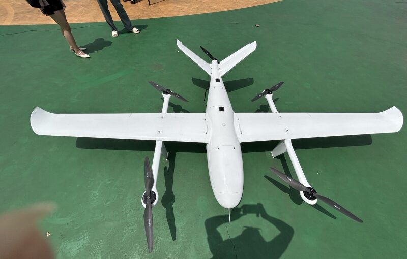
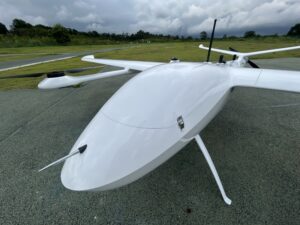
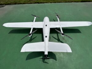
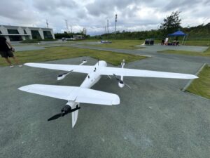
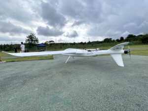
Large-scale precision agriculture and long-range infrastructure engineering represent two of the most demanding operational domains for modern commercial UAV technology. Traditional ground sampling, manned satellite imaging, and standard multirotor drones often fail to balance coverage area, spatial resolution, and operational flexibility. Multirotor aircraft lack the battery endurance required to scan thousands of agricultural acres or stretch across dozens of kilometers of linear transportation corridors in a single mission. Conversely, legacy fixed-wing drones demand expansive, clear runways or catapult launchers—luxuries rarely available on unpaved farmland or constrained construction rights-of-way. Vertical Takeoff and Landing (VTOL) hybrid aircraft eliminate these barriers by combining vertical launch agility with high-efficiency fixed-wing cruise flight. Equipping these hybrid platforms with specialized multispectral sensors, high-resolution RGB cameras, and integrated RTK/PPK GNSS receivers allows enterprise operators to collect precise spatial data across expansive landscapes with unprecedented speed and accuracy.
Table of Contents
- 1. How a Fixed-Wing VTOL UAV with a Multispectral Camera Transforms Precision Agriculture
- 2. Why a VTOL Drone is Essential for Corridor Mapping and Topographic Surveying
- 3. Multispectral Sensor Science: From Spectral Bands to Actionable Crop Indices
- 4. Technical Considerations for High-Precision Linear Topographic Mapping
- 5. Enterprise Platform and Sensor Integration Matrix
- 6. Frequently Asked Questions (FAQ)
How a Fixed-Wing VTOL UAV with a Multispectral Camera Transforms Precision Agriculture
Answer for Featured Snippet: A fixed-wing VTOL UAV with a multispectral camera for agriculture transforms farm management by covering thousands of acres per flight to capture narrow light bands—such as RedEdge and Near-Infrared (NIR)—invisible to the human eye. These specialized sensors allow agronomists to generate precision vegetation indices (like NDVI and NDRE), detect crop stress weeks before visual symptoms appear, optimize variable-rate fertilizer applications, and dramatically reduce chemical input costs across massive commercial farming operations.
Managing industrial agriculture operations requires rapid, repeatable crop health insights over vast geographical areas. Standard visual (RGB) imagery captures only visible light spectrums, revealing plant stress only after significant cellular damage has already occurred. A fixed-wing VTOL UAV carrying a narrow-band multispectral camera overcomes this limitation by capturing light reflected across multiple distinct electromagnetic bands, including Green, Red, RedEdge, and Near-Infrared (NIR).
Healthy plants containing high concentrations of active chlorophyll absorb red light while strongly reflecting near-infrared radiation. By measuring the precise ratio of reflected NIR to red light, specialized multispectral sensors detect subtle drops in photosynthetic activity caused by early-stage drought stress, nutrient deficiencies, soil compaction, or pest infestations long before foliage shows visible yellowing. Combining this advanced optical sensor technology with a long-endurance fixed-wing VTOL platform allows agronomists to survey up to 1,500–2,500 hectares in a single flight. Farmers receive targeted, spatial prescription maps that guide variable-rate fertilizer sprayers and irrigation equipment, maximizing crop yield while minimizing fertilizer waste.
Why a VTOL Drone is Essential for Corridor Mapping and Topographic Surveying
Answer for Featured Snippet: A VTOL drone for corridor mapping and topographic surveying is essential because it eliminates the need for clear ground runways while delivering the extended range necessary to map long, narrow infrastructure assets—such as highways, power lines, pipelines, and railways. When integrated with RTK/PPK GNSS positioning, a VTOL platform produces centimeter-accurate 3D terrain models, contour maps, and orthomosaics across dozens of linear kilometers per mission.
Linear infrastructure projects present unique spatial surveying challenges. Mapping a 50-kilometer highway corridor, a proposed railway expansion, or a high-voltage transmission line using standard quadcopters requires field crews to constantly leapfrog along the route, setting up dozens of separate takeoff and landing sites. Traditional fixed-wing drones cover long distances efficiently, but landing them along narrow, forested, or mountainous corridors carries a high risk of belly-landing structural damage or tree collision.
A hybrid fixed-wing VTOL drone solves both logistical problems simultaneously. It launches vertically from a compact 3×3 meter clearing—such as an unpaved road shoulder, a clearing inside a mountain valley, or a gravel staging area—before transitioning into high-speed horizontal cruise flight to cover extensive linear distances. When paired with high-resolution full-frame photogrammetry cameras and onboard RTK/PPK GNSS receivers, these aircraft capture geotagged imagery with centimeter-level spatial accuracy. Surveyors use this data to build dense 3D point clouds, digital surface models (DSM), and detailed contour maps essential for civil engineering design, cut-and-fill earthwork calculations, and right-of-way encroachment monitoring.
Multispectral Sensor Science: From Spectral Bands to Actionable Crop Indices
Converting raw multispectral sensor captures into actionable agricultural decisions relies on processing specific spectral band reflections through proven mathematical formulas. Unlike standard RGB sensors that capture broad visible light, enterprise multispectral payloads—such as the MicaSense Series (RedEdge-P, Altum-PT) or integrated multispectral camera arrays—isolate distinct, narrow spectral bands:
- Normalized Difference Vegetation Index (NDVI): Calculated as
(NIR - Red) / (NIR + Red). NDVI serves as the industry-standard benchmark for evaluating overall crop vigor, plant density, and seasonal canopy growth across mid-to-late growth stages. - Normalized Difference Red Edge (NDRE): Calculated as
(NIR - RedEdge) / (NIR + RedEdge). The RedEdge band penetrates deeper into dense crop canopies than red light. NDRE provides superior insight into nitrogen absorption and chlorophyll levels in mature crops where standard NDVI values become saturated. - Soil-Adjusted Vegetation Index (SAVI): Incorporates a soil-brightness correction factor to deliver accurate canopy health measurements during early crop emergence stages when exposed soil dominates the camera’s field of view.
- Thermal Infrared Analysis: Integrated thermal bands measure actual canopy temperature. Plants closing their stomata to conserve water during drought show immediate temperature spikes, giving farm managers an early indicator of irrigation system failures.
These calculated index layers are exported as standardized GeoTIFF prescription files directly into Farm Management Information Systems (FMIS) or smart tractor controllers. This data allows automated farm machinery to adjust nitrogen and water delivery dynamically across specific field zones down to the individual plant level.
Technical Considerations for High-Precision Linear Topographic Mapping
Executing long-range corridor mapping missions requires strict adherence to specialized flight planning parameters and data processing mechanics to prevent data distortion across narrow geographic spans:
1. Optimized Corridor Flight Path Planning
Unlike standard block grid mapping flights over square agricultural fields, corridor missions follow linear centerline vectors. Flight planning software creates multi-pass corridor paths that maintain consistent side-lap (typically 60–70%) and front-lap (75–85%) coverage across winding roads or transmission lines. Advanced ground control software automatically adjusts camera trigger intervals based on real-world ground speed to guarantee uniform image overlap despite changing wind conditions.
2. Real-Time Terrain Following Mechanics
Corridor surveying frequently crosses mountainous terrain, river basins, and varying elevation profiles. To maintain a constant Ground Sampling Distance (GSD) and prevent scale distortion in final orthomosaic outputs, the VTOL aircraft must utilize real-time 3D terrain-following flight modes. The autopilot reads high-resolution Digital Elevation Models (DEMs) in real time, dynamically adjusting the aircraft’s altitude above ground level (AGL) throughout the mission.
3. Eliminating “Bowl Effect” Model Distortion
Long, narrow single-line aerial photogrammetry datasets are highly susceptible to vertical curvature distortion, commonly called the “bowl effect.” To prevent this elevation warp without requiring ground crews to lay physical Ground Control Points (GCPs) every few hundred meters, operators combine high-precision dual-frequency RTK/PPK GNSS positioning with high-resolution full-frame cameras equipped with mechanical global shutters. The precise camera triggering timing, combined with rigorous bundle block adjustments in processing software (such as Pix4Dmatic or Agisoft Metashape), ensures rock-solid vertical accuracy across dozens of kilometers.
Enterprise Platform and Sensor Integration Matrix
To assist corporate GIS departments, forestry agencies, and enterprise agronomists in selecting the optimal hardware configurations, the matrix below outlines leading fixed-wing VTOL platforms alongside their primary sensor integrations and operational capabilities.
| UAV Platform & Model | Primary Targeted Application | Max Endurance & Range | Compatible Sensor Payload | Key Data Output & Accuracy |
|---|---|---|---|---|
| Quantum Systems Trinity Pro | Precision Agriculture & Surveying | 90 Minutes (up to 100 km) | MicaSense RedEdge-P / Sony RX1R II | Centimeter-grade NDVI/NDRE maps, 3D DTMs via PPK |
| WingtraWingtraOne GEN II | Agricultural Scouting & Topography | 59 Minutes (up to 10 km link) | MicaSense Altum-PT / 42MP RGB | Sub-centimeter GSD photogrammetry, high-res thermal/NIR |
| JOUAV CW-15 | Long-Range Linear Corridor Surveying | 180 Minutes (up to 180 km) | Full-Frame 100MP RGB / LiDAR | Dense 3D point clouds, corridor contour maps |
| DeltaQuad Evo Enterprise | Multi-Payload Agriculture & Patrol | 240+ Minutes (up to 280 km) | Dual Multispectral + RGB Zoom Pods | Real-time multi-spectral streaming, long-range corridor thermal |
Frequently Asked Questions (FAQ)
Q1: Why is a fixed-wing VTOL drone superior to a standard quadcopter for agricultural multispectral mapping?
While quadcopters are suitable for scouting small farm plots under 50 hectares, their limited flight time (typically 25 to 35 minutes) makes mapping large commercial farms slow and inefficient. A fixed-wing VTOL drone utilizes its aerodynamic wings to generate lift during cruise flight, consuming significantly less battery power. This efficiency allows a single VTOL flight to cover 1,000 to 2,000+ hectares in a single battery cycle while maintaining the vertical takeoff flexibility needed to operate from field borders without a runway.
Q2: Can a single VTOL flight carry both a multispectral camera and a high-resolution RGB camera simultaneously?
Yes. Many modern enterprise fixed-wing VTOL platforms feature multi-payload bays or modular quick-swap sensor housings. Advanced multispectral sensors (such as the MicaSense RedEdge-P) feature an integrated high-resolution panchromatic sensor that optically fuses multispectral bands with high-resolution panchromatic imagery (pan-sharpening). This delivers ultra-high-resolution multispectral data and crisp RGB outputs from a single sensor payload during one flight.
Q3: How many Ground Control Points (GCPs) are required when using an RTK-enabled VTOL drone for corridor surveying?
When using an RTK/PPK-enabled VTOL drone equipped with a calibrated global-shutter camera, the required number of physical GCPs drops by 80% to 90%. Instead of placing targets every few hundred meters along the route, operators only need to set up 2 to 4 independent quality-check targets at the start, middle, and end of the corridor to validate the software’s final accuracy report.
Q4: How do solar irradiance sensors improve multispectral mapping accuracy during changing weather conditions?
Solar irradiance sensors mounted on the top surface of the VTOL aircraft continuously measure incoming sunlight intensity throughout the flight. If cloud cover fluctuates while the drone is mapping, the sensor logs the changing solar radiation levels for every image frame. Photogrammetry processing software uses this calibration data to normalize reflectance values across the entire dataset, ensuring that crop health indices (like NDVI) reflect true plant health rather than variations in cloud shadow.