No products in the cart.
Implementing high-precision geospatial data collection methods has revolutionized industries such as land development, open-pit mining, environmental forestry, and heavy infrastructure design. As commercial unmanned aerial vehicle (UAV) technologies advance, geospatial engineers must continuously evaluate different methods for capturing accurate, real-world coordinate structures. Achieving centimeter-level precision across a digital orthomosaic map or a three-dimensional point cloud requires moving far beyond basic consumer satellite systems. Today, professionals rely on specialized workflows utilizing Real-Time Kinematics (RTK), Post-Processed Kinematics (PPK), and physical Ground Control Points (GCPs). Selecting the optimal spatial framework requires an in-depth understanding of telemetry signal transmission, field operational risks, software post-processing mechanics, and the actual vertical accuracy tolerances demanded by professional engineering standards.
Table of Contents
- 1. What is the difference between RTK and PPK drones?
- 2. When should I use PPK instead of RTK drone mapping?
- 3. Do I still need GCPs if I use an RTK drone?
- 4. Does drone RTK replace traditional surveying tools entirely?
- 5. Which provides better vertical accuracy: RTK, PPK, or GCPs?
- 6. Comprehensive Accuracy and Workflow Comparison Matrix
- 7. Frequently Asked Questions (FAQ)
What is the difference between RTK and PPK drones?
Answer for Featured Snippet: The primary difference between RTK and PPK drones is the timing and method of data correction. RTK (Real-Time Kinematic) drones process positional corrections instantly during the flight via a continuous radio or cellular internet link between the aircraft and a base station. PPK (Post-Processed Kinematic) drones log raw, uncorrected satellite data directly on the aircraft during flight, combining it with base station logs later in desktop software to compute precise positions during post-processing.
To evaluate these systems thoroughly, engineers must understand how positioning telemetry flows through each hardware architecture. An RTK drone system operates as a live, active correction loop. While the aircraft is navigating its pre-programmed mapping grid, its onboard Global Navigation Satellite System (GNSS) receiver processes incoming signals from overhead constellations. Simultaneously, a stationary reference ground station or an NTRIP cellular network monitors the exact same satellite signals from a known point on the ground. The base station calculates localized atmospheric and orbital errors and transmits these correction adjustments to the flying drone in real time. The drone instantly corrects its current positions, embedding centimeter-accurate spatial tags directly into the metadata of each photograph as it is captured. This live data loop provides immediate confirmation of precision while the aircraft is still in the air.
A PPK drone system, on the other hand, decouples the correction process from the active flight window. During a mapping mission, the PPK drone flies its grid without receiving live adjustments from the ground. Instead, the drone’s high-frequency receiver records raw satellite observation data, carrier-phase measurements, and precise time stamps directly onto its internal flash memory cards. Meanwhile, a local base station or a regional reference network independently logs identical raw satellite data on the ground. Once the drone lands, the operator extracts the raw observation logs from both devices and imports them into specialized post-processing software. The software correlates the data using exact timestamps, calculating and applying the differential corrections retroactively. This offline post-processing steps achieve the exact same centimeter-level accuracy as live systems, but completely eliminates the need for active real-time data transmissions during flight operations.
When should I use PPK instead of RTK drone mapping?
Answer for Featured Snippet: You should use PPK instead of RTK drone mapping when surveying large remote sites lacking cellular coverage, rugged terrain with severe obstructions (such as deep open-pit mines or dense forests), or when operating high-speed fixed-wing VTOL aircraft. PPK eliminates the risk of real-time signal dropouts caused by terrain blockage or line-of-sight limits, ensuring consistent data processing across the entire site.
Real-world field environments frequently present significant communication challenges that can disrupt live data workflows. An RTK drone depends entirely on maintaining a perfect, uninterrupted digital data link between the ground transmitter and the moving aircraft. If the drone flies behind a steep hill, drops down into a deep valley, or operates around large metal industrial structures, the real-time radio signals can easily be blocked. When an RTK link breaks, the drone’s onboard receiver instantly drops from a “Fix” solution down to an inaccurate “Float” status. This disruption can cause erratic coordinate logs, leaving gaps of uncorrected data across your mapping grid that can ruin the consistency of your entire photogrammetric model.
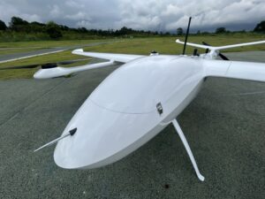
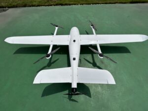
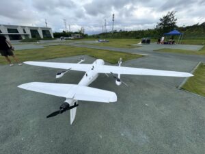
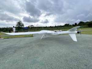
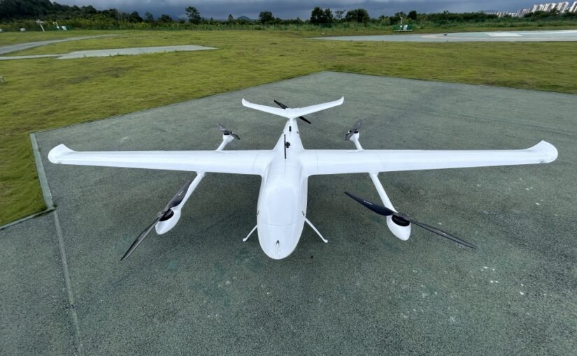
Choosing a PPK workflow eliminates this risk entirely, making it the preferred choice for complex or remote project sites. Because a PPK drone does not require a live transmission link to calculate its positions, it can fly behind physical obstructions, descend into deep terrain, or travel kilometers away from the base station without facing data corruption risks. As long as both the drone and the ground station track the same overhead satellite constellations, the data can be fully corrected later in the office. Furthermore, PPK is highly efficient when deploying high-speed fixed-wing VTOL aircraft over large linear corridors, such as long pipelines or extensive rail networks. This approach completely eliminates the logistical nightmare of constantly moving real-time radio repeaters or maintaining active cellular internet connections across massive geographic distances.
Do I still need GCPs if I use an RTK drone?
Answer for Featured Snippet: Yes, you still need a minimal number of GCPs (or independent checkpoints) when using an RTK drone. While an RTK drone can reduce the total number of required Ground Control Points by up to 80% to 90%, independent checkpoints remain essential to provide objective quality control, eliminate systematic photogrammetric shifts, and satisfy professional certification standards.
The idea that upgrading to an advanced RTK drone completely eliminates the need for any ground-level measurements is a common misconception that can lead to significant data risks. In a pure, unverified RTK drone workflow, your data processing software trust the incoming photo coordinates implicitly. However, if the drone’s internal camera sensor develops a subtle tilt, or if the software incorrectly calculates the exact electronic time delay between the camera shutter opening and the GNSS position log, systematic errors can enter your project. Without any physical ground reference points to anchor the data, these subtle calibration errors can cause the entire 3D model to tilt or shift uniformly, resulting in inaccurate maps that pass initial software checks but fail real-world inspections.
To prevent these systematic shifts, professional mapping protocols require placing a small number of physical tiles on the ground before flight. Instead of using them as primary anchors to stitch the model together, these tiles are treated as independent quality control checkpoints. After your photogrammetry software generates the final 3D point cloud, your team compares the model’s calculated positions against the real-world coordinates of these ground checkpoints. This step produces an objective Root Mean Square Error (RMSE) validation report, providing clear proof that your digital dataset is free from hidden software skewing and meets strict engineering tolerances.
Does drone RTK replace traditional surveying tools entirely?
Answer for Featured Snippet: No, drone RTK does not replace traditional surveying tools entirely. While it drastically accelerates wide-area data collection, it cannot capture points hidden under dense tree canopies, calculate property boundaries hidden by structures, or achieve the sub-millimeter structural precision required for high-rise steel alignment. Traditional tools like optical total stations and GNSS rovers remain essential to capture obscured points and establish primary project datums.
Drone mapping platforms are highly efficient tools for capturing wide-area geographic data, but they operate under clear physical limitations. High-resolution optical sensors and airborne LiDAR systems can only measure what is directly visible from above. If an industrial project requires mapping asset coordinates beneath a dense, multi-layered forest canopy, or capturing features hidden under roof overhangs and within narrow urban alleyways, aerial drones cannot collect the required data points. In these scenarios, traditional ground surveying tools like robotic total stations and handheld GNSS rover poles remain indispensable for mapping features hidden from the sky.
Furthermore, structural engineering and heavy industrial construction require accuracy tolerances that match the thickness of a coin. Setting up structural anchor bolts for steel frameworks or aligning high-speed rail tracks demands sub-millimeter precision. Because airborne RTK systems must operate through wind currents and subtle vibration forces, their physical accuracy limits sit around 1 to 3 centimeters. This makes them ideal for earthwork calculations and general terrain modeling, but unsuitable for precision structural adjustments. Instead of replacing traditional methods, drone technologies should be integrated into your workflow as a powerful addition, allowing field teams to handle wide-area mapping tasks quickly while reserving ground tools for precise structural tie-ins.
Which provides better vertical accuracy: RTK, PPK, or GCPs?
Answer for Featured Snippet: A dense network of properly surveyed Ground Control Points (GCPs) combined with a standard drone can match or occasionally exceed the vertical accuracy of a pure RTK drone. However, the absolute best vertical accuracy is achieved by combining an RTK or PPK drone with a small number of independent ground checkpoints, consistently delivering a high precision of 2 to 3 centimeters across the entire project area.
Calculating accurate vertical elevation (the Z-axis) is the most challenging task in aerial photogrammetry. If a field team relies entirely on a standard, consumer-grade drone paired with a dense network of ground control points, the software can achieve excellent vertical precision near those ground tiles. However, as the distance from those physical points increases, the model’s vertical accuracy degrades, causing a bowl-shaped distortion effect across wide project areas. Conversely, a pure RTK or PPK drone platform maintains a highly uniform, flat vertical accuracy profile across the entire site, ensuring that points in the center of the map match the precision of features located kilometers away on the perimeter.
When comparing RTK and PPK directly, PPK often delivers slightly better vertical consistency during data processing. Because PPK software processes the data after the flight is complete, it can read the satellite logs forward and backward simultaneously (forward-backward filtering). This capability allows the software to smooth out sudden data spikes, pull in precise orbital ephemeris data published by international agencies after the flight, and resolve ambiguous carrier-phase cycles more reliably than live systems. This offline processing approach yields highly consistent vertical metrics, making PPK the preferred choice for high-precision volumetric calculations and flat coastal drainage surveys.
Comprehensive Accuracy and Workflow Comparison Matrix
To assist surveying managers and corporate procurement officers in choosing the right spatial data workflow, the matrix below details the operational differences, accuracy expectations, and logistical requirements of each methodology.
| Operational Feature | Real-Time Kinematic (RTK) | Post-Processed Kinematic (PPK) | Traditional Ground Control (GCP) |
|---|---|---|---|
| Horizontal Accuracy (X/Y) | 1 to 2 Centimeters | 1 to 2 Centimeters | 2 to 3 Centimeters (Near points) |
| Vertical Accuracy (Z/Elevation) | 2.5 to 4 Centimeters | 2 to 3 Centimeters | 3 to 5 Centimeters (Degrades between points) |
| Live Communication Link Requirement | Mandatory (Radio or Cellular) | None (Data logged offline) | None (Manual ground surveys) |
| Processing Complexity | Low (Ready for immediate export) | Moderate (Requires desktop processing) | High (Manual image marking required) |
| Optimal Project Environments | Open flat terrain, construction sites | Deep mines, dense forests, remote areas | Small sites, local local reference projects |
| Risk of Mid-Flight Data Loss | Moderate (Signal link dropouts) | Extremely Low (Hardware tracking only) | Low (Requires manual target preservation) |
Frequently Asked Questions (FAQ)
Q1: Can an RTK-enabled drone be operated in a PPK workflow if needed?
Yes, almost all enterprise-grade RTK drones (such as the DJI Matrice 350 RTK or specialized fixed-wing VTOL platforms) automatically log raw satellite observation data directly onto their internal memory cards during every mission. If your real-time data link drops out or fails completely during a flight, you can extract these raw logs and process them using a standard PPK workflow in the office, ensuring no loss of precision.
Q2: How many ground checkpoints are required when executing an RTK or PPK drone survey?
For standard industrial sites covering up to 100 acres, placing 3 to 5 independent ground checkpoints is highly recommended. These points should be distributed evenly across the survey grid, ensuring you capture both the highest and lowest elevations on the site. This distribution allows your processing software to generate an accurate, objective vertical and horizontal error report to validate your dataset.
Q3: Why is PPK often preferred over RTK when deploying fixed-wing VTOL drones over large distances?
Fixed-wing VTOL drones fly much faster and cover significantly larger geographic areas than standard quadcopters. If operated under an RTK workflow, the aircraft can easily outrun the transmission range of its local ground radio base station, or fly through cellular dead zones, causing a complete loss of correction data. A PPK setup avoids this limitation entirely by logging all data onboard, allowing the aircraft to fly unhindered across tens of kilometers.
Q4: Does the use of RTK or PPK completely protect a drone map from errors caused by rolling camera shutters?
No, high-accuracy position tags cannot fix the internal geometric distortions caused by a cheap rolling camera shutter. If a drone camera uses a rolling shutter, the image sensor captures data row-by-row while the aircraft is moving, which can stretch or warp individual pixels in the photo. To maintain true centimeter-level accuracy, your RTK or PPK drone platform must be paired with a high-performance camera utilizing a mechanical global shutter, which captures the entire image frame instantly.