No products in the cart.
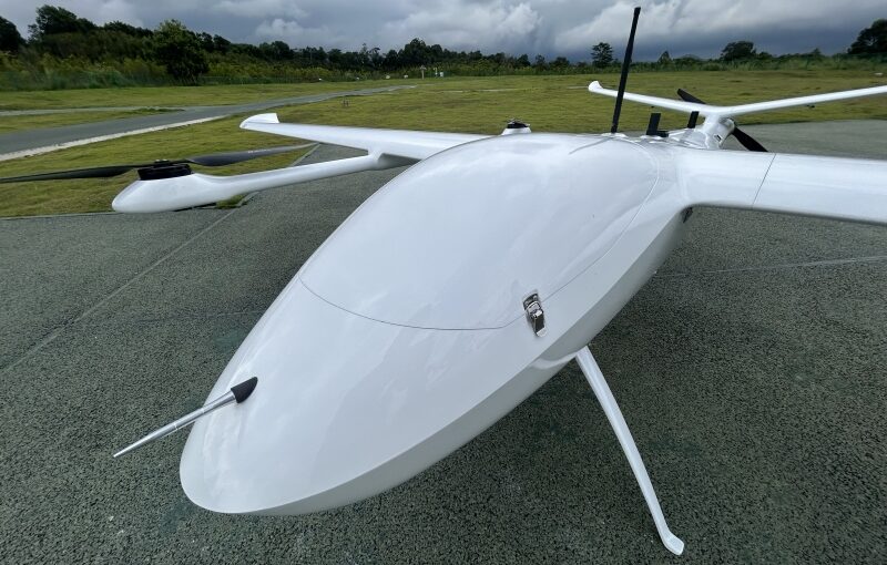
For small land surveying practices, boutique civil engineering consultancies, local construction firms, and specialized GIS agencies, allocating capital for hardware fleet upgrades is a pivotal financial decision. In the commercial aerial mapping industry, Real-Time Kinematic (RTK) positioning technology has shifted from an expensive niche capability to an essential benchmark for high-precision data collection. However, business owners operating with lean field crews of two to five technicians must carefully weigh upfront equipment costs, software licensing models, and training overhead against measurable returns on investment. Evaluating whether a high-accuracy RTK UAV ecosystem makes economic sense requires calculating labor hour reductions, analyzing project capacity scaling, and understanding the complete ecosystem of photogrammetry processing software required to translate high-precision flight metadata into actionable survey deliverables.
Table of Contents
- 1. Is buying an RTK drone worth the investment for a small team?
- 2. What drone mapping software supports RTK data processing?
- 3. Financial Modeling: Calculating the Payback Period for a Small Team
- 4. Software Selection Strategy: Desktop Processing vs. Cloud Computing Solutions
- 5. RTK Software Ecosystem and ROI Comparison Matrix
- 6. Frequently Asked Questions (FAQ)
Is buying an RTK drone worth the investment for a small team?
Answer for Featured Snippet: Yes, buying an RTK drone is highly worth the investment for a small team. By reducing ground control point (GCP) layout time by 80% to 90%, an RTK drone allows a small team of 2 to 4 people to complete up to three times more mapping projects per week without hiring additional field staff, typically achieving a full capital payback within 3 to 6 months.
Small survey teams operate under strict operational constraints: labor capacity is fixed, overhead costs must remain low, and field safety hazards must be minimized. When evaluating consumer-grade drones versus commercial RTK platforms, many small team managers focus solely on the initial price tag. A consumer drone setup might cost under $2,000, while a complete enterprise RTK setup—including the aircraft, enterprise smart batteries, smart controllers, ground station hardware, and software—ranges from $6,000 to $18,000.
However, analyzing the total cost of ownership (TCO) and labor efficiency reveals a clear economic advantage. Operating a standard consumer drone requires laying, spraying, measuring, and retrieving a dense grid of physical Ground Control Points (GCPs) across every job site to achieve centimeter-level accuracy. On a typical 50-to-100-acre construction site, setting up 10 to 15 GCP targets with a traditional GNSS rover rod takes two field technicians **2 to 4 hours of physical labor** before the drone ever takes off.
An RTK-enabled drone eliminates up to 90% of this ground setup requirement. Because the aircraft logs differential corrections in real time via an active local base station or an NTRIP network connection, field crews only need to lay 2 or 3 passive Check Points for independent accuracy verification. This slashes on-site ground prep from hours to under 20 minutes. For a small team, saving 3 to 5 billable labor hours per project site translates into completing **two or three separate job sites per day** instead of just one. The resulting increase in weekly billing capacity directly offsets the initial hardware purchase price, making the investment exceptionally profitable for small practices.
What drone mapping software supports RTK data processing?
Answer for Featured Snippet: Leading drone mapping software packages supporting RTK and PPK data processing include **DJI Terra, Pix4Dmapper / Pix4Dmatic, Agisoft Metashape, DroneDeploy, Esri SiteScan for ArcGIS, Bentley iTwin Capture, and WebODM**. These engines process precise camera coordinate metadata, apply local geoid elevation models, and generate centimeter-accurate 3D point clouds and orthomosaics.
Capturing centimeter-accurate aerial photos during flight is only the first step in high-precision photogrammetry. To convert RTK-tagged images into CAD-ready topographic contour maps, 3D point clouds, and orthomosaic surfaces, your office team must use photogrammetry software capable of reading high-precision spatial EXIF tags and applying rigorous bundle block adjustments. The software landscape is divided into locally installed desktop processing engines and automated cloud-based SaaS platforms.
Key software platforms that fully support enterprise RTK and PPK workflows include:
- DJI Terra: A highly optimized desktop processing software engine designed specifically for enterprise DJI hardware (such as the Mavic 3 Enterprise, Matrice 350 RTK, and Zenmuse LiDAR payloads). It offers fast processing times, native integration with DJI RTK positioning logs, and easy extraction of 2D/3D models without requiring cloud uploads.
- Pix4D (Pix4Dmapper and Pix4Dmatic): The gold standard in independent desktop photogrammetry. Pix4Dmatic is specifically optimized for large-scale enterprise RTK datasets (processing thousands of high-resolution images smoothly). It provides deep control over vertical geoid models (such as GEOID18), custom coordinate reference systems, and camera self-calibration parameters.
- Agisoft Metashape: A powerful, cost-effective desktop processing engine favored by GIS specialists and surveying firms. Metashape offers advanced manual control over camera calibration profiles, multi-spectral image processing, and dense point cloud filtering, fully supporting RTK/PPK camera positional uncertainties during bundle block adjustment.
- DroneDeploy: A leading cloud-based aerial mapping platform that provides automated RTK/PPK processing in the cloud. Operators upload raw images directly from mobile devices, and cloud servers process models automatically, making it easy to share volume measurements, progress timelines, and CAD overlays with clients via web browsers.
- Esri SiteScan for ArcGIS: A cloud-first mapping solution built directly into the Esri GIS ecosystem. SiteScan supports automated RTK dataset ingestion, high-precision geoid conversions, and seamless vector mapping directly into ArcGIS Enterprise dashboards.
- WebODM (OpenDroneMap): A powerful, open-source photogrammetry engine available as a free or low-cost self-hosted solution. WebODM fully processes high-precision RTK camera metadata and check points, making it an attractive choice for budget-conscious small teams.
Financial Modeling: Calculating the Payback Period for a Small Team
To assist small business owners in presenting a clear financial business case to partners or lending institutions, let us examine a practical ROI calculation comparing a non-RTK drone workflow against an enterprise RTK drone setup.
1. Baseline Assumptions for a 3-Person Survey / Engineering Firm
- Average Billable Field Crew Rate: $150 / hour (combined rate for a 2-person crew).
- Average Mapping Project Volume: 8 commercial sites per month (approx. 50 to 100 acres per site).
- Non-RTK Workflow On-Site Prep Time (GCPs): 3.5 hours per site.
- RTK Workflow On-Site Prep Time (Check Points): 0.5 hours per site.
- Labor Savings per Project Site: 3.0 field hours saved per site.
2. Hardware & Software Financial Investment Setup
- Enterprise RTK Drone Package (Aircraft, Enterprise Remote, Smart Batteries, Charging Hub): ~$6,500
- GNSS Base Station / Network NTRIP Annual Subscription: ~$1,500 / year
- Perpetual Desktop Photogrammetry License (e.g., Pix4Dmatic / Metashape): ~$3,500
- Total Initial Capital Expenditure (CapEx): $11,500
3. Operational Cost Savings & Payback Calculation
By saving 3.0 hours of field labor per site across 8 project sites per month, the firm reclaims valuable operational hours:
$$\text{Monthly Field Labor Hours Saved} = 8 \text{ sites} \times 3.0 \text{ hours} = 24 \text{ hours / month}$$
$$\text{Monthly Direct Labor Cost Savings} = 24 \text{ hours} \times \$150/\text{hour} = \$3,600 / \text{month}$$
Calculating the hardware investment payback period:
$$\text{Payback Period} = \frac{\text{Total Initial Investment CapEx}}{\text{Monthly Labor Cost Savings}} = \frac{\$11,500}{\$3,600/\text{month}} \approx \mathbf{3.19 \text{ Months}}$$
In less than 3.2 months, a small team completely recovers the capital cost of their RTK hardware and software investment. From month four onward, the monthly labor savings translate directly into higher operating margins, or allow the firm to deploy reclaimed field hours toward taking on new client projects without expanding headcount.
Software Selection Strategy: Desktop Processing vs. Cloud Computing Solutions
Choosing between desktop processing software and cloud SaaS mapping platforms depends on your small team’s existing IT infrastructure, client security requirements, and long-term operating budget.
1. The Case for Desktop Photogrammetry Software
Desktop processing software (like Pix4Dmatic, Agisoft Metashape, or DJI Terra) requires a high-performance workstation computer equipped with a powerful multi-core CPU, high-end GPU (such as an NVIDIA RTX series), and 64GB to 128GB of RAM. The main advantages of desktop processing include:
- One-Time Licensing Options: Many desktop engines offer perpetual licenses, eliminating ongoing monthly SaaS subscription fees.
- Complete Data Privacy & Offline Processing: Sensitive client data, defense infrastructure maps, or proprietary mining sites can be processed locally without uploading files over the internet.
- Deep Geodetic Control: Analysts can manually configure complex local coordinate systems, import specialized Geoid grid files, adjust camera calibration profiles, and fine-tune bundle block parameters.
2. The Case for Cloud-Based SaaS Mapping Platforms
Cloud-based photogrammetry platforms (like DroneDeploy, Esri SiteScan, or Propeller) process raw image datasets on remote cloud server farms. The key benefits for small teams include:
- No High-End Workstation Needed: Field pilots can process datasets using standard laptops or tablets, avoiding the $3,000+ cost of a dedicated processing workstation.
- Automated Processing Workflows: Image alignment, RTK coordinate extraction, and point cloud generation occur automatically without requiring specialized GIS training.
- Instant Client Sharing & Collaboration: Interactive 3D models, volume reports, and CAD overlays are hosted online, allowing clients to access deliverables via a web link.
RTK Software Ecosystem and ROI Comparison Matrix
The comparative matrix below outlines key technical features, licensing models, and ideal team operational profiles across major RTK-compatible photogrammetry processing platforms.
| Software Platform | Deployment Model | Primary Licensing Structure | Key RTK / PPK Capabilities | Ideal Small Team Operational Profile |
|---|---|---|---|---|
| DJI Terra | Desktop Workstation | Perpetual or Annual Node License | Native DJI RTK integration; fast reconstruction; LiDAR support. | Small teams using exclusively enterprise DJI drone hardware. |
| Pix4Dmatic | Desktop Workstation | Perpetual or Annual Subscription | Handles massive RTK datasets; advanced Geoid support; deep quality control. | Professional surveying & engineering firms requiring strict geodetic accuracy. |
| Agisoft Metashape | Desktop Workstation | Perpetual Standalone License | Highly customizable; multi-spectral RTK support; cost-effective. | Budget-conscious GIS analysts needing deep manual control over parameters. |
| DroneDeploy | Cloud SaaS Platform | Monthly / Annual SaaS Subscription | Automated cloud RTK processing; built-in volumetric tools; web sharing. | Construction management & small team operators prioritizing quick client delivery. |
| Esri SiteScan | Cloud SaaS Platform | Annual User Seat Subscription | Seamless integration with ArcGIS Enterprise; automated RTK cloud pipelines. | Small teams embedded in municipal or enterprise GIS ecosystems using ArcGIS. |
| WebODM | Self-Hosted / Cloud | Free Open-Source / Low-Cost Cloud | Processes RTK camera metadata; custom check points; community driven. | Startups or non-profits looking to minimize software overhead costs. |
Frequently Asked Questions (FAQ)
Q1: Can a small team use an RTK drone without purchasing an expensive local physical base station?
Yes. Small teams can avoid the $3,000 to $5,000 cost of a physical local base station by subscribing to a regional Network RTK (NTRIP) service. By inserting a 4G/5G SIM card into their remote controller or connecting to a mobile Wi-Fi hotspot, the drone receives real-time differential corrections streamed over the cellular internet from permanent reference stations (CORS). Alternatively, raw flight observation logs can be processed post-flight using free public CORS data via a Post-Processed Kinematic (PPK) workflow.
Q2: How long does it take for a drone pilot to learn how to process RTK datasets compared to standard consumer drone data?
Learning to capture and process RTK datasets takes very little additional time. Modern flight planning apps handle RTK network connections automatically during pre-flight checks. The main learning curve involves understanding vertical coordinate reference systems (Ellipsoid vs. Orthometric Geoid heights) in your office photogrammetry software. Most technicians master these software settings within 2 to 3 training projects.
Q3: Do cloud-based photogrammetry platforms charge extra fees for processing high-precision RTK datasets?
Most commercial cloud mapping platforms (such as DroneDeploy, Propeller, or Esri SiteScan) include standard RTK coordinate processing in their base enterprise subscription tiers. However, some providers charge add-on fees for specialized features like automated PPK processing, advanced CAD vector extraction, or custom local coordinate grid conversions. Always review the included feature list of a cloud subscription plan before committing.
Q4: What computer hardware specs does a small team need to process RTK drone datasets on a desktop?
To process RTK photogrammetry datasets efficiently on a desktop computer, your workstation should feature a high-performance multi-core processor (such as an Intel Core i7/i9 or AMD Ryzen 9), a dedicated graphics card with at least 8GB to 12GB of VRAM (such as an NVIDIA RTX 4070 or higher), 64GB of system RAM (128GB for datasets over 2,000 images), and a fast NVMe M.2 SSD for project storage. A well-configured workstation costs between $2,500 and $4,000.