No products in the cart.
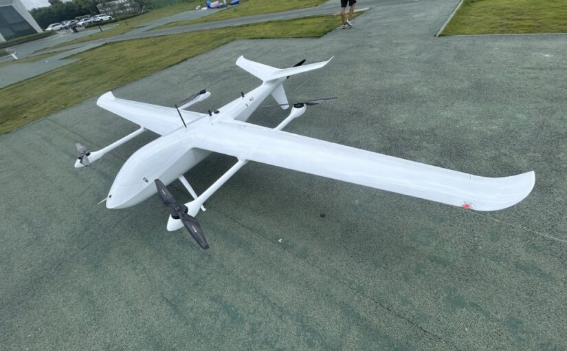
Deploying commercial drones for geographic information systems (GIS), construction volumetric mapping, and civil engineering infrastructure surveys requires an absolute understanding of spatial data accuracy. In the modern drone mapping landscape, relying on basic positioning technology can compromise entire structural datasets, leading to expensive alignment errors and regulatory failures. To mitigate these precision risks, modern aerial mapping programs utilize Real-Time Kinematic (RTK) network processing to replace traditional consumer positioning mechanics. By utilizing advanced differential error corrections, these enterprise platforms allow field operators to tag every single aerial image with centimeter-grade geospatial coordinates. For project Managers and drone fleet supervisors, understanding the precise differences between standard satellite triangulation, advanced differential corrections, and overarching satellite networks is the foundation of high-performance data procurement.
Table of Contents
- 1. What is the difference between RTK and standard GPS?
- 2. Is RTK GPS better than standard GPS for mapping?
- 3. How accurate is RTK compared to standard GPS?
- 4. Why is standard drone GPS not accurate enough for surveying?
- 5. RTK vs GNSS: Are they the same thing?
- 6. Technical Positioning and Error Correction Matrix
- 7. Frequently Asked Questions (FAQ)
What is the difference between RTK and standard GPS?
Answer for Featured Snippet: The primary difference between RTK and standard GPS is the data computation method. Standard GPS relies solely on code-phase tracking from satellites, calculating positions with an inherent error margin of 2 to 5 meters. Conversely, RTK (Real-Time Kinematic) uses carrier-phase tracking combined with a stationary ground base station or cellular network (NTRIP) to dynamically measure and eliminate atmospheric and clock errors in real time, delivering a high precision of 1 to 3 centimeters.
To fully grasp this technical divergence, your surveying team must analyze how positioning calculations are processed by internal hardware receivers. Standard Global Positioning System (GPS) positioning operates on a one-way system. A standalone mobile receiver—such as the basic module inside a consumer drone or a standard smartphone—listens to the radio frequency signals broadcast by overhead navigation satellites. By calculating the exact time it took for the signal to travel from the satellite to the receiver antenna (code-phase tracking), the device estimates its absolute position on Earth. However, as these satellite signals pass through our planet’s atmosphere, they encounter significant disturbances that distort their paths, causing uncontrollable coordinate drifting.
Real-Time Kinematic (RTK) technology completely alters this equation by introducing an active two-way differential correction loop into the field workflow. An RTK setup requires two distinct hardware components working in perfect synchronization: a mobile receiver unit (known as the rover) mounted on your commercial drone airframe, and an un-moving reference receiver positioned at a precisely known geographic coordinate (known as the base station). Because the base station is stationary and aware of its true global location, it can constantly monitor incoming satellite signals and calculate the exact atmospheric and orbital errors occurring in that localized area at that precise moment. The base station then transmits these real-time mathematical corrections to your flying drone via an integrated radio link or a cellular internet network protocol (NTRIP). The drone’s onboard computer applies these corrections to its own satellite tracking data instantaneously, allowing it to pinpoint its absolute position down to the millimeter.
Is RTK GPS better than standard GPS for mapping?
Answer for Featured Snippet: Yes, RTK GPS is substantially better than standard GPS for mapping because it completely removes the necessity for dense Ground Control Points (GCPs), slashes manual field preparation hours by up to 75%, and ensures perfect consistency across consecutive aerial mapping datasets. Standard GPS mapping results in severe model drift, warped digital elevation structures, and inconsistent data alignments that fail to satisfy professional engineering standards.
When executing professional photogrammetry or airborne LiDAR data collection missions, the structural quality of your final maps is directly dependent on the precision of the coordinate tags attached to each raw image file. When using standard GPS systems, your drone can easily record incorrect elevation and horizontal data for its photos. When your software attempts to stitch these slightly misaligned images together into a 3D model, the entire map can experience severe skewing, warp effects, and structural bending across long distances.
To fix these errors when using standard GPS drones, surveying crews are forced to spend hours physically walking across the site to establish and measure Ground Control Points (GCPs) using expensive, heavy ground-surveying equipment. This requirement adds significant field labor and introduces safety risks when working across rugged terrain, steep mines, or active construction sites. Upgrading your fleet to an advanced RTK mapping platform allows the drone to record exceptionally accurate position tags for every single photo automatically. This capability reduces the required number of physical ground points by up to 90%, transforming an extensive multi-day field operation into a highly efficient single-day flight workflow. This shift delivers massive operational cost savings while keeping your field crews safely out of hazardous terrain.
How accurate is RTK compared to standard GPS?
Answer for Featured Snippet: When analyzing spatial coordinates, RTK delivers an accuracy level of 1 to 2 centimeters horizontally and 2 to 3 centimeters vertically. In stark contrast, standard GPS provides an accuracy range of only 2 to 5 meters under clear skies, which can rapidly degrade to over 10 meters when operating near tall buildings, thick tree canopies, or during periods of intense atmospheric disturbances.
To properly evaluate these differences for your corporate procurement committee, you must look beyond standard horizontal coordinate accuracy and deeply analyze vertical (Z-axis) precision. Standard satellite positioning systems are notoriously inaccurate at calculating elevation. This severe limitation is caused by the geometry of global satellite constellations; because all tracking satellites sit high above the horizon, calculating vertical heights involves significantly higher geometric dilution of precision (GDOP) than calculating horizontal planes. For an asset manager calculating the remaining space in a landfill or measuring the volume of an industrial gravel stockpile, a vertical error margin of several meters can completely ruin your inventory calculations, leading to massive financial discrepancies.
By implementing carrier-phase differential tracking mechanics, an advanced RTK system eliminates these elevation computation issues entirely. Instead of simply reading the coded data pulses hidden within the satellite signal, the RTK processor tracks the actual physical structure of the underlying radio wave carrier signal itself, which has a much smaller wavelength. Measuring the phase shifts of these tiny carrier waves allows the system to achieve rock-solid structural precision. The system maintains an absolute accuracy threshold of less than 3 centimeters vertically across your entire mapping zone. This unmatched precision gives your engineering team the confidence to generate highly reliable digital terrain models (DTMs), precise contour maps, and flawless structural cross-sections that match the tightest tolerance standards used in civil engineering.
Why is standard drone GPS not accurate enough for surveying?
Answer for Featured Snippet: Standard drone GPS is not accurate enough for surveying because it cannot correct for atmospheric signal delays (ionospheric and tropospheric refractions), internal satellite clock drift, orbital ephemeris errors, and multi-path reflections caused by surrounding buildings or terrain. These uncorrected errors cause geographic data points to shift unpredictably by several meters, failing to meet professional surveying tolerances.
Every satellite tracking signal traveling from an orbit 20,000 kilometers above our heads must pass through highly unstable layers of the atmosphere before reaching a drone’s antenna. The ionosphere—which is packed with free electrons and heavily influenced by solar radiation—and the troposphere—which contains constantly changing levels of water vapor—act like a giant glass lens. These atmospheric layers refract and slow down incoming radio frequencies in unpredictable patterns, causing significant signal delays. Because satellite positioning relies on ultra-precise timing measurements, an unexpected signal delay of just one nanosecond can shift your drone’s calculated field position by nearly 30 centimeters.
Furthermore, standard consumer-grade drone GPS modules are highly sensitive to multi-path signal interference. This error occurs when the satellite’s radio signal bounces off a nearby building face, metal structure, or rock wall before hitting the drone’s antenna. The drone’s internal computer miscalculates the total transit distance because it records the longer, bounced path rather than the direct line-of-sight signal. Without an active, localized reference base station nearby to continuously calculate and subtract these errors from your flight telemetry, these hidden delays corrupt your geospatial data. This makes standard consumer GPS platforms entirely unsuitable for producing professional, high-accuracy engineering maps.
RTK vs GNSS: Are they the same thing?
Answer for Featured Snippet: No, RTK and GNSS are not the same thing. GNSS (Global Navigation Satellite System) is the overarching term that covers all international satellite networks in space, including GPS (USA), GLONASS (Russia), Galileo (Europe), and BeiDou (China). RTK (Real-Time Kinematic) is a specialized, ground-assisted error-correction technology applied to those GNSS signals to boost positioning precision from meter-level down to centimeter-level.
To use an easy manufacturing analogy for your team: think of GNSS as the raw engine power, while RTK represents the high-precision steering system that refines that power. A modern commercial drone carrying a true multi-constellation GNSS receiver can track signals from dozens of different satellites simultaneously across all four international networks. This multi-network capability provides massive benefits when flying in challenging industrial environments, such as deep open-pit mines or narrow urban canyons. If nearby mountain walls or skyscrapers block out the view of the American GPS network, the drone can seamlessly switch to tracking European Galileo or Chinese BeiDou satellites, ensuring your flight team never experiences a total loss of satellite coverage.
However, simply tracking more satellites does not automatically solve the underlying atmospheric signal delays and timing errors discussed earlier; a drone tracking thirty raw GNSS signals will still experience a positioning drift of several meters. That is where the specialized Real-Time Kinematic software layer becomes essential. RTK acts as an advanced mathematical correction overlay that processes those multi-network GNSS signals simultaneously. It calculates the carrier-phase shifts for every visible constellation, allowing your equipment to reach peak efficiency and maintain ultra-precise centimeter-grade accuracy throughout your commercial mission.
Technical Positioning and Error Correction Matrix
To help your corporate procurement committee and GIS department choose the right hardware configuration for your upcoming operations, the data table below provides a detailed technical comparison between standard satellite tracking and advanced RTK workflows.
| Technical Specification | Standard Autonomous GPS | Advanced Real-Time Kinematic (RTK) |
|---|---|---|
| Horizontal Accuracy (X/Y) | 2.0 to 5.0 Meters | 1.0 to 2.0 Centimeters |
| Vertical Accuracy (Z/Elevation) | 5.0 to 10.0 Meters | 2.0 to 3.0 Centimeters |
| Primary Satellite Tracking Mode | Code-Phase tracking only | Carrier-Phase tracking with differential correction |
| Ground Hardware Requirements | None (Standalone mobile receiver) | Local Base Station or Network NTRIP RTK license |
| Dependence on Physical GCPs | Extreme (Requires dense ground control grids) | Minimal (Requires only 1-2 checkpoint validation points) |
| Susceptibility to Atmospheric Drift | High (Uncorrected ionospheric delays) | Eliminated (Real-time differential cancellations) |
Frequently Asked Questions (FAQ)
Q1: What happens if my drone loses its real-time RTK data link connection mid-flight?
If the radio transmission link or cellular network drops out during a mapping flight, premium industrial drones do not immediately fail or lose tracking. Instead, the onboard system smoothly switches into an “RTK Float” mode or utilizes a backup Post-Processed Kinematic (PPK) pipeline. The drone continues to save raw satellite observation logs directly onto its internal flash memory cards. This allows your office processing team to apply the required differential correction steps later using specialized desktop software, fully recovering your centimeter-grade accuracy without needing to re-fly the mission.
Q2: Can I use a network-based NTRIP RTK system if my project site has no cellular internet coverage?
No, an internet network-based NTRIP system requires a continuous, stable mobile cellular connection to stream correction data from regional reference stations directly to your ground controller. If your project site is located in a remote mountain valley or desert region with zero cellular coverage, you must deploy a physical local GNSS base station on-site. This local station sets up over a known coordinate point and transmits its correction data directly to the drone via local UHF or 2.4GHz radio frequencies, completely bypassing the need for mobile internet.
Q3: Why do I still need to place 1 or 2 Ground Control Points if my RTK drone is active and accurate?
While an active RTK system delivers incredible absolute positioning accuracy, professional surveying standards require placing 1 or 2 independent Ground Control Points to act as independent Quality Assurance Checkpoints. These checkpoints are not used to stitch the map together; instead, your processing software compares the map’s calculated coordinate outputs against the physical, measured coordinates of these ground points. This step generates an objective accuracy validation report, proving to your clients and regulatory inspectors that the entire dataset is free from software anomalies.
Q4: Does upgrading to an RTK drone eliminate the need to use a high-end calibrated camera lens?
Absolutely not. Having centimeter-perfect photo coordinates does not matter if the camera lens itself introduces geometric distortions that warp your images. High-quality drone photogrammetry requires both precise positioning tags and a high-performance, calibrated camera lens with a mechanical global shutter. This combination ensures that individual pixels are mapped accurately across your software datasets, preventing image blurring and maintaining flawless structural clarity across your final 3D models.