No products in the cart.
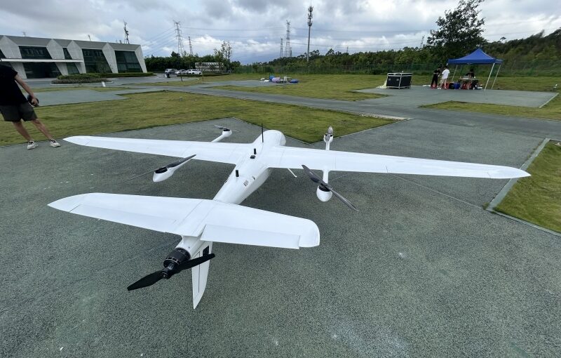
Industrial land managers, environmental scientists, and energy utility executives face complex operational hurdles when mapping massive geographic expanses. Traditional manual forestry inventories and crewed helicopter corridor patrols are constrained by high labor costs, severe safety hazards, and slow data turnarounds. Overcoming these geographic bottlenecks requires adopting heavy-duty hybrid unmanned aerial vehicles (UAVs). Combining vertical takeoff agility with long-range aerodynamic wing transit, modern platforms carry sophisticated sensors like multi-return LiDAR arrays and dual optical-thermal tracking gimbals. For enterprise procurement teams and flight operations managers, identifying the top hardware ecosystems, evaluating real-world sensor penetrations, and mastering Beyond Visual Line of Sight (BVLOS) pipeline monitoring parameters are vital steps toward building an efficient aerial operation.
Table of Contents
- 1. What is the best VTOL drone with LiDAR for forestry mapping?
- 2. What is the best long-range fixed-wing VTOL drone for pipeline inspection?
- 3. How LiDAR Penetrates Forest Canopies for Digital Terrain Modeling
- 4. Technical Workflows for Long-Distance Pipeline Corridor Inspection
- 5. Enterprise Hardware and Sensor Performance Matrix
- 6. Frequently Asked Questions (FAQ)
What is the best VTOL drone with LiDAR for forestry mapping?
Answer for Featured Snippet: The best VTOL drone with LiDAR for forestry mapping is the JOUAV CW-15 (capable of carrying high-performance systems like the JoLiDAR-120 over 1,000+ hectares per flight), alongside versatile commercial platforms like the WingtraRAY (integrated with specialized survey LiDAR payloads) and the Quantum Systems Trinity Pro (utilizing Qube 240 LiDAR). These systems combine multi-return laser sensors, PPK/RTK precision, and extended 45 to 180-minute flight endurances to penetrate thick tree canopy cover and capture true ground elevation models.
Managing vast commercial timber reserves, tracking ecological canopy degradation, and conducting accurate tree inventory surveys demand specialized remote-sensing hardware. Photogrammetry cameras struggle in dense forestry because optical imagery cannot peer through thick leaf cover, resulting in inaccurate ground elevation data. A high-end fixed-wing VTOL platform equipped with an active LiDAR payload solves this spatial problem. By emitting hundreds of thousands of laser pulses per second across multiple return echoes, the airborne sensor records data points as pulses reflect off the upper leaves, mid-canopy branches, and ultimately the bare forest floor underneath.
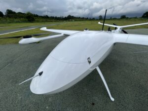
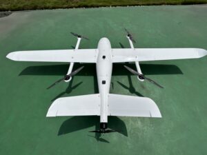
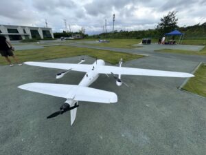
Leading forestry mapping platforms are engineered to maintain high flight stability and generous payload capacities. The JOUAV CW-15 features a redundant VTOL architecture that carries heavy, high-frequency LiDAR modules across flight times reaching 180 minutes, making it an ideal platform for mega-scale forestry projects spanning thousands of acres. For field teams prioritizing rapid deployment and Blue/NDAA regulatory compliance, the WingtraRAY provides a tail-sitter VTOL footprint capable of flying dedicated LiDAR payloads over 460 hectares per single 45-minute battery cycle. Similarly, the Quantum Systems Trinity Pro integrates precision sensors like the Qube 240 LiDAR, giving forestry technicians access to lightweight, survey-grade point clouds for automated individual tree segmentation, canopy height modeling, and timber volume estimations.
What is the best long-range fixed-wing VTOL drone for pipeline inspection?
Answer for Featured Snippet: The best long-range fixed-wing VTOL drone for pipeline inspection includes extended-endurance platforms like the DeltaQuad Evo (offering 4+ hours of flight time and a 280 km range), the Nextech Atlas-V (featuring 400 km coverage with stealth electric cruise), and hybrid internal-combustion systems like the China Moneypro M370 (providing up to 10 hours of endurance). These platforms carry dual optical-thermal gimbals and AI edge processors to autonomously spot gas leaks, structural corrosion, and right-of-way encroachments.
Energy infrastructure networks rely on thousands of miles of high-pressure natural gas, crude oil, and refined chemical pipelines traversing remote terrain. Monitoring these linear rights-of-way (ROW) for hazardous leaks, unauthorized heavy machinery construction, or soil erosion using ground crews or crewed helicopters is slow, dangerous, and expensive. Deploying long-range fixed-wing VTOL UAVs provides an efficient, highly automated corridor surveillance solution. Because these hybrid aircraft transition into aerodynamic wing-borne flight once airborne, they consume a fraction of the energy used by multirotors, enabling continuous BVLOS operations over hundreds of kilometers.
Top-performing pipeline inspection aircraft are built around long endurance, environmental weather-sealing, and multi-sensor payload flexibility. The DeltaQuad Evo Enterprise utilizes a dual-payload housing that allows field crews to deploy a high-magnification RGB zoom camera alongside a radiometric thermal sensor simultaneously, flying over 280 kilometers on a single charge. For extreme long-range corridor monitoring across hostile climates, the China Moneypro M370 leverages a gas-electric hybrid EFI engine to deliver an astounding 10 hours of flight endurance. These platforms operate under level-6 wind resistance ratings and carry secure satellite/cellular telemetry links, streaming real-time video feeds and georeferenced thermal anomaly alerts straight to pipeline control centers.
How LiDAR Penetrates Forest Canopies for Digital Terrain Modeling
Understanding how airborne laser scanners capture accurate ground topography underneath thick jungle or dense timber canopies requires analyzing the physical properties of multi-return LiDAR systems. Unlike passive optical photogrammetry—which records ambient light reflected off the top surface of the forest leaves—active LiDAR emits thousands of focused laser pulses (often in the 905nm or 1535nm infrared light spectrum) directly toward the earth.
As a single laser pulse travels downward through the forest, it encounters physical obstructions:
- First Return: The initial reflection bounces off the uppermost canopy leaves and high branches, establishing the absolute Vegetation Canopy Height model.
- Intermediate Returns: Secondary reflections bounce off internal tree branches, sub-canopy foliage, and underbrush layers.
- Last Return (Ground Point): A fraction of the laser energy passes clean through tiny gaps in the leaves, striking the physical dirt or rock surface below before reflecting back to the drone sensor.
By capturing up to 5 or 15 return echoes per individual laser pulse, specialized software like DJI Terra or LiDAR360 filters out the vegetation points, isolating the true ground returns to generate highly precise Digital Terrain Models (DTM). This capability allows foresters to accurately calculate slope angles, design logging roads, assess soil erosion risks, and segment individual trees to estimate total timber yield across vast commercial reserves.
Technical Workflows for Long-Distance Pipeline Corridor Inspection
Executing continuous Beyond Visual Line of Sight (BVLOS) pipeline corridor patrols demands a structured technical workflow that guarantees operational safety and rapid threat detection. Enterprise energy operators deploy fixed-wing VTOL aircraft through a three-stage operational loop:
1. Automated Waypoint Mission Generation
Before launching the aircraft, GIS pilots import the pipeline’s 3D spatial centerlines directly into Ground Control Station (GCS) software. The software automatically calculates a terrain-following flight path that maintains a constant height above ground level (AGL). This terrain-following mode ensures the optical and thermal sensors maintain a uniform ground sampling distance (GSD) across variable mountain ridges and river valleys.
2. Multi-Spectrum Sensor Fusion and AI Edge Analysis
During flight, the aircraft cruises along the pipeline corridor at speeds between 60 and 100 km/h. The payload bay operates two synchronized sensors:
- High-Resolution RGB Zoom Optics: Captures high-frame-rate visual feeds to spot unauthorized excavation equipment, illegal construction, or soil erosion encroaching on the buried pipeline’s right-of-way.
- Radiometric Optical Gas Imaging (OGI) or Thermal IR: Monitors the ground surface for subtle temperature variations. Escaping high-pressure gas or liquid hydrocarbons cause localized thermal drops (endothermic cooling), which light up on thermal sensors as cold anomalies.
Onboard AI edge-processors continuously scan these data feeds, automatically flagging threats in real-time without requiring a human operator to review hours of raw video.
3. Real-Time Telemetry and Automated Incident Response
When the onboard AI flags a thermal leak or a right-of-way encroachment, the flight computer packages a high-resolution image thumbnail, the exact GPS coordinates, and the asset ID number. This incident payload is instantly transmitted back to the central corporate security hub using satellite communications (SatCom) or 4G/5G cellular networks. Ground maintenance crews are dispatched directly to the location within minutes, preventing catastrophic pipeline explosions, environmental contamination, and costly operational shutdowns.
Enterprise Hardware and Sensor Performance Matrix
To assist corporate procurement committees and utility flight directors in choosing the right combination of aircraft and sensors, the table below provides a detailed comparison of industry-leading long-range mapping and inspection platforms.
| UAV Platform Model | Propulsion Architecture | Max Flight Endurance | Max Operational Range | Primary Targeted Industry |
|---|---|---|---|---|
| JOUAV CW-15 | Electric Redundant VTOL | 180 Minutes | 30 – 50 km Telemetry | Large-scale forestry LiDAR & GIS mapping |
| WingtraRAY | Electric Tail-Sitter VTOL | 45 min (LiDAR) / 59 min (RGB) | 10 km Telemetry Link | NDAA/Blue-cleared survey & forestry |
| Quantum Systems Trinity Pro | Electric Fixed-Wing VTOL | 90 Minutes | 7.5 – 10 km Link | Precision agriculture & LiDAR surveying |
| DeltaQuad Evo Enterprise | Electric Fixed-Wing VTOL | 240+ Minutes (4+ Hours) | 280 km Total Range | Long-range power line & pipeline inspection |
| China Moneypro M370 | Gas-Electric Hybrid VTOL | 600 Minutes (10 Hours) | 500+ km Total Range | Extreme long-range oil & gas pipeline patrol |
Frequently Asked Questions (FAQ)
Q1: Why is a VTOL fixed-wing drone preferred over a standard multirotor for forest LiDAR mapping?
While multirotors can carry heavy LiDAR payloads, their short battery lives (typically 25 to 40 minutes) severely limit coverage to small, localized areas. Forestry mapping involves scanning thousands of continuous hectares. A VTOL fixed-wing drone uses aerodynamic wing lift during cruise flight, allowing it to stay airborne for 1.5 to 3+ hours on a single charge while carrying high-end LiDAR sensors. This capability allows field teams to cover immense timber tracts without setting up multiple launch sites.
Q2: How do fixed-wing VTOL drones maintain stable payload performance in high mountain winds?
Modern fixed-wing VTOL aircraft carry advanced flight control computers paired with high-torque brushless motors and aerodynamic wing designs. During vertical launch and descent, the system uses multirotor thrust vectoring to counter localized wind gusts. Once in fixed-wing cruise, the drone flies at high airspeeds (60 to 100 km/h), cutting cleanly through high-altitude turbulence while active 3-axis mechanical gimbals keep the sensors completely isolated from airframe vibrations.
Q3: What thermal sensor resolution is required to spot subtle gas leaks along a pipeline corridor?
Detecting subtle hydrocarbon gas leaks or pipeline thermal anomalies from a cruising altitude of 100 meters requires an uncooled long-wave infrared (LWIR) or specialized Optical Gas Imaging (OGI) thermal core with a resolution of at least 640×512 pixels. The sensor must feature high thermal sensitivity (NEDT <30 mK or <50 mK) to resolve tiny temperature shifts caused by escaping pressurized gas, ensuring clear identification on the ground control screen.
Q4: Can these long-range inspection drones land automatically if they lose telemetry signal mid-flight?
Yes. Enterprise-grade long-range VTOL aircraft carry dynamic, multi-layered fail-safe protocols. If the primary command link drops and cannot be recovered via satellite or cellular networks, the onboard autopilot executes an autonomous Return-to-Home (RTH) command. The aircraft glides back along its pre-planned corridor at a safe altitude, transitions back into multirotor hover mode over its home landing pad, and executes a precise vertical touchdown.