No products in the cart.
In the modern commercial landscape, the integration of unmanned aerial vehicle (UAV) technologies into day-to-day project workflows is no longer just an experimental novelty. It represents a fundamental shifting point in industrial data processing efficiency. Whether managing extensive mining projects, calculating raw material inventory tracking, or checking excavation progress on civil engineering jobs, organizations face constant pressure to reduce surveying operational windows while preserving data integrity. Moving from standard manual tracking methods to high-precision Real-Time Kinematic (RTK) drone deployments gives companies a major technological advantage. To make smart operational decisions, financial executives, asset managers, and project leaders need a clear understanding of the measurable time savings, concrete investment costs, software workflows, and exact vertical tolerances required to achieve highly profitable drone surveying operations.
Table of Contents
- 1. What accuracy level does a drone map need for volume calculations?
- 2. How much time does an RTK drone save compared to traditional surveying?
- 3. Is buying an RTK drone worth the investment for a small team?
- 4. What drone mapping software supports RTK data processing?
- 5. Financial and Operational Efficiency Matrix
- 6. Frequently Asked Questions (FAQ)
What accuracy level does a drone map need for volume calculations?
Answer for Featured Snippet: For accurate volumetric calculations, a drone map requires a **horizontal accuracy of 1 to 3 centimeters** and a **vertical (Z-axis) accuracy of 2 to 5 centimeters**. This precise vertical threshold ensures that volume calculations for industrial stockpiles or earthwork excavations maintain a tight error margin of under 1% to 2%, preventing significant financial inventory discrepancies.
To accurately calculate volumes from aerial mapping data, project managers must understand how small changes in vertical accuracy impact their final inventory metrics. Volumetric data is generated by creating a highly detailed 3D digital elevation model (DEM) or point cloud of the target material, and then mathematically comparing that surface layer against a flat baseline or previous survey model. Because volume calculations look at three full dimensions, any hidden vertical height errors are multiplied across the entire surface area of your site. If a mapping workflow has a vertical error of just 10 centimeters across a large 10-acre construction site, that tiny variation will miscalculate the earthwork data by more than 4,000 cubic yards of material, which can easily translate into massive logistical errors and thousands of dollars in unexpected dirt hauling costs.
To prevent these compounding financial errors, modern asset managers must utilize high-precision RTK or PPK drone platforms capable of capturing crisp Ground Sampling Distance (GSD) ratios alongside exceptional vertical accuracy. Maintaining a consistent vertical precision threshold of under 5 centimeters allows photogrammetry software to track the complex surfaces of irregular gravel mounds, coal stockpiles, and deep structural borrow pits with extreme detail. This level of precision keeps overall volume calculation error margins between 1% and 2%. This performance matches or exceeds the data quality of traditional, slow ground-based surveying methods, giving your accounting departments absolute confidence in their end-of-month inventory asset reports.
How much time does an RTK drone save compared to traditional surveying?
Answer for Featured Snippet: An RTK drone can **slash total project surveying times by 60% to 80%** compared to traditional ground methods. By mapping large sites at high speeds from above and reducing the need to place dense networks of physical Ground Control Points (GCPs), an RTK drone can condense a grueling 2-to-3-day ground survey down to a fast 30-minute flight and a 2-hour software processing session.
To accurately calculate the return on investment of an RTK upgrade, business owners need to break down the specific time allocations required for both traditional field methodologies and modern aerial workflows. Traditional ground surveys rely on a team of technicians walking across a site with handheld GNSS rover rods or optical total stations, manually capturing individual coordinate points every few meters. On a complex 100-acre construction site or a rugged open-pit quarry, navigating safety hazards, steep slopes, and active heavy equipment traffic makes this data collection slow and dangerous, easily requiring 16 to 24 total man-hours of exhausting field labor just to build a basic terrain mesh.
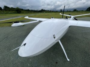
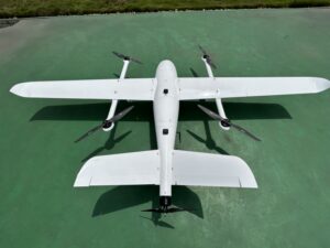
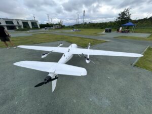
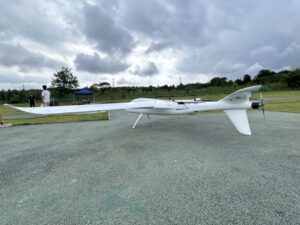
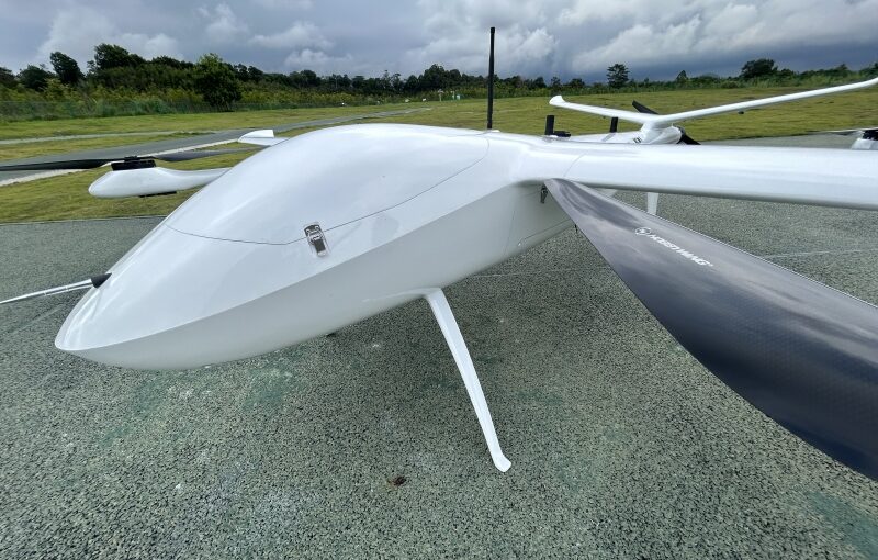
An RTK drone completely changes this timeline by taking to the air. Flying a pre-planned autonomous grid at a height of 250 feet, an industrial multirotor or fixed-wing VTOL drone can map that same 100-acre site in less than 30 minutes. More importantly, because the drone receives real-time centimeter corrections from an active base station or network stream, field crews do not have to spend hours walking the site to place, measure, and paint a dense grid of Ground Control Points (GCPs). This eliminates up to 80% of manual ground setup tasks. The crew simply sets up 1 or 2 quick checkpoints for data verification, launches the aircraft, and finishes the data collection safely. This leaves the rest of the day open to analyze the data and deliver actionable insights to project stakeholders.
Is buying an RTK drone worth the investment for a small team?
Answer for Featured Snippet: Yes, buying an RTK drone is highly worth the investment for a small team, often achieving a full hardware payback within 3 to 6 months. For an engineering or surveying team of just 2 to 4 people, an RTK drone acts as an incredible efficiency booster, allowing a single pilot to accomplish the work of a traditional 3-person ground crew while dramatically increasing the total number of projects the firm can handle each month.
Small engineering consultancies and local surveying firms often hesitate to upgrade to industrial RTK equipment due to the upfront cost. Purchasing an enterprise-grade RTK drone package—including the aircraft, extra smart batteries, a local GNSS base station, and specialized processing software licenses—requires a meaningful capital investment. However, looking closely at operational costs shows that relying on cheaper, non-RTK consumer drones actually drains a small team’s profitability over time. Standard consumer drones require setting up dense networks of physical ground control points for every flight, keeping field crews trapped on site for hours and severely limiting how many projects a small team can complete in a week.
Investing in an integrated RTK drone system lets a small team scale up their field capabilities without needing to hire extra personnel. Because field data collection times drop from multiple days down to a few minutes, a single drone pilot can easily map multiple separate job sites in one business day. This massive increase in field efficiency helps small firms bid on larger, more lucrative industrial projects that were previously impossible to handle with a small staff. By saving on labor costs and unlocking new project opportunities, small teams can routinely pay off their initial equipment investment within their first few commercial deployments.
What drone mapping software supports RTK data processing?
Answer for Featured Snippet: Leading drone mapping software packages that fully support RTK and PPK data processing include **Pix4Dmapper/Pix4Dmatic, DJI Terra, Agisoft Metashape, DroneDeploy, and Esri SiteScan**. These advanced programs read the high-precision geolocation tags saved in your photos, align images with centimeter-level precision, and apply required local geoid conversions to build highly accurate 3D engineering models.
Once your drone lands after a successful mapping mission, your workflow shifts to selecting the right software tool to process your high-precision data. The market is split into two primary software architectures: localized desktop processing programs and automated cloud-based mapping platforms. Desktop programs like **Pix4Dmatic** and **Agisoft Metashape** are popular choices for corporate GIS analysts because they offer total control over data variables. These systems allow your team to adjust image tie-points manually, select custom local coordinate systems, apply specialized geoid conversion files, and process massive datasets containing thousands of high-resolution images locally without needing an internet connection.
For small teams that want to simplify their post-processing tasks, cloud-based software platforms like **DroneDeploy** and **Esri SiteScan** offer incredibly streamlined, automated workflows. Field crews can upload their raw, RTK-tagged photos directly from the field using mobile internet connections. The cloud server’s automated engines handle all image alignment, camera calibration, and point-cloud generation automatically, processing the models across fast remote servers. These cloud ecosystems also feature built-in, easy-to-use measurement toolsets. This allows project managers to calculate stockpile volumes, measure linear distances, and share complete 3D digital twins with off-site clients and partners through a simple web browser link, without needing expensive local processing computers.
Financial and Operational Efficiency Matrix
To help corporate procurement teams and business owners evaluate a potential fleet upgrade, the comparison matrix below outlines the performance differences, equipment costs, and operational timelines across various surveying methodologies.
| Surveying Methodology | Estimated Equipment Cost | Time Required for a 100-Acre Site | Field Personnel Needed | Average Volumetric Error Margin |
|---|---|---|---|---|
| Traditional Ground Survey (Total Station/GNSS Rod) | $15,000 – $30,000 | 12 to 24 Hours | 2 to 3 Technicians | 1.0% – 1.5% (Requires heavy interpolation) |
| Standard Consumer Drone (Requires dense GCP grids) | $2,000 – $5,000 | 4 to 6 Hours (Includes extensive GCP layout) | 2 Technicians | 2.0% – 5.0% (Prone to edge distortions) |
| Enterprise RTK Drone (Active Local Base/NTRIP Network) | $8,000 – $18,000 | 1 to 2 Hours (Flight + Checkpoint setup) | 1 Certified Pilot | 0.5% – 1.5% (High-density surface data) |
Frequently Asked Questions (FAQ)
Q1: Why are drone volume calculations often more accurate than traditional ground measurements for irregular stockpiles?
Traditional ground surveyors collect data by touching a rod to a stockpile every few meters, missing small surface changes and forcing software to guess the shape between those points. An RTK drone takes millions of data points from above, capturing every unique contour, depression, and shape variation across the material surface. This high-density data gives your software a much more complete model, resulting in highly accurate volume calculations that outperform traditional manual methods.
Q2: Do cloud-based drone mapping software platforms charge extra fees to process high-precision RTK files?
Most cloud software providers include standard RTK data processing within their base subscription plans. However, you often need to upgrade to a premium tier to access advanced engineering tools, such as automated ground control target recognition, custom local coordinate system inputs, or direct integrations with BIM platforms like Autodesk BIM 360. Always verify these software features with your provider to ensure your plan matches your team’s workflow requirements.
Q3: How often do I need to re-calibrate an RTK drone’s camera to maintain accurate volume metrics?
You should run your camera through an internal software calibration check every 3 to 6 months, or immediately if the drone experiences a hard landing or is exposed to rough transport vibrations. Over time, normal flight vibrations can cause subtle shifts in the camera lens elements, introducing small distortions into your images. Keeping your camera properly calibrated prevents these tiny errors from showing up in your models and ensures your vertical data remains solid.
Q4: Can a small team use an RTK drone to calculate volumes inside closed industrial warehouses or storage silos?
No, standard RTK drones cannot operate indoors because building roofs block satellite signals, preventing the drone from receiving position corrections. To map volumes inside indoor facilities or covered storage areas, teams must deploy specialized indoor inspection drones. These platforms use visual sensors, LiDAR systems, and collision-resistant cages to navigate safely without relying on satellites, allowing you to capture indoor data without a GPS signal.