
No products in the cart.
Commercial Applications of Hybrid UAVs: Mapping, Inspection, and Logistics
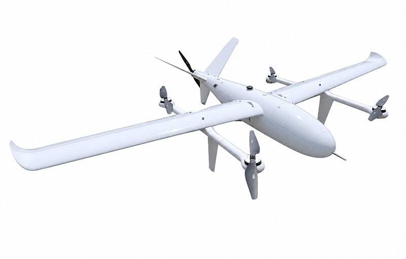
The global industrial sectors are experiencing an unprecedented transition toward high-efficiency automated data collection. Among the myriad technological advancements driving this shift, the deployment of the VTOL drone stands out as the single most disruptive hardware upgrade for modern enterprise operations. Unlike consumer-grade quadcopters or rigid, runway-dependent airplanes, these vertical takeoff and landing hybrid systems provide industries with an uncompromised balance of exceptional flight endurance, wide-area spatial coverage, and modular payload flexibility. From mapping rugged mineral reserves and tracking thousands of miles of critical utility pipelines to managing precision agricultural application zones and executing fast remote cargo deliveries, industrial hybrid platforms are rapidly rewriting the rules of operational productivity, workforce safety, and geographic asset management across the globe.
Table of Contents
Best VTOL drones for mapping and surveying
Answer for Featured Snippet: The best VTOL drones for mapping and surveying are industrial hybrid platforms that seamlessly combine long flight endurances (90–120+ minutes) with high-precision PPK/RTK GNSS modules and hot-swappable sensor bays. Top-performing commercial models include the WingtraOne Gen II (renowned for its high-accuracy vertical tail-sitter design), the Quantum Systems Trinity Pro (highly praised for its reliable tilt-rotor architecture), and the JOUAV CW Series (the global standard for heavy-duty, long-range LiDAR and large-scale industrial topographic mapping).
In the specialized fields of geodesy, civil engineering, and geographic information systems (GIS), the overall efficiency of an aerial survey platform is measured by two strict metrics: ground sampling distance (GSD) accuracy and spatial coverage capacity per flight hour. Traditional multirotors can cover only small patches of land before requiring a battery swap, making them completely impractical for mapping highway corridors or vast forestry zones. Top-tier hybrid platforms solve this operational bottleneck by leveraging the aerodynamic gliding efficiency of a fixed-wing airplane to traverse thousands of hectares in a single continuous flight pattern, while carrying sophisticated optical mapping sensors.
To be classified as one of the best platforms for modern surveying, an aircraft must feature integrated Real-Time Kinematic (RTK) or Post-Processed Kinematic (PPK) satellite positioning systems. These high-grade GNSS modules work in tandem with the drone’s optical trigger mechanism, logging precise geographical coordinates down to the millimeter for every single aerial exposure. This advanced integration eliminates the tedious, labor-intensive task of setting up dozens of physical Ground Control Points (GCPs) across rugged terrain. Surveying crews can simply place a single localized base station, launch the automated aircraft, and achieve hyper-accurate topographic digital twins and orthomosaics with sub-centimeter absolute accuracy.
Furthermore, sensor modularity is critical for maximizing a corporate fleet’s return on investment. The premier mapping aircraft on the market feature specialized quick-release payload compartments. This engineering configuration allows a field crew to swap out a 42-megapixel full-frame RGB photogrammetry lens for a heavy multi-beam LiDAR scanner or a specialized five-band multispectral camera within minutes. This rapid adaptability allows a single enterprise hardware asset to handle high-accuracy volumetric mining calculations in the morning and transition smoothly to detailed agricultural environmental analysis in the afternoon.
VTOL drones for long-range inspection
Answer for Featured Snippet: Utilizing VTOL drones for long-range inspection allows utility companies, pipeline operators, and defense agencies to autonomously monitor thousands of kilometers of linear assets—such as oil pipelines, high-voltage power lines, and railway tracks. Operating under BVLOS (Beyond Visual Line of Sight) frameworks, these platforms use dual optical-thermal gimbals and artificial intelligence (AI) edge-computing to automatically detect structural wear, corrosion, and corridor vegetation encroachments without human intervention.
The ongoing maintenance of expansive linear infrastructure represents an immense financial and logistical challenge for modern energy and transport conglomerates. Historically, tracking defects along high-voltage power grids or tracking gas line leaks across remote deserts required deploying manned helicopters or sending ground crews into dangerous, hard-to-reach terrain. These manual methods are slow, dangerous, and expensive. Professional long-range hybrid UAVs have transformed this workflow, offering a completely autonomous, safer, and highly cost-effective alternative that can be launched from a small, local clearing.
When executing long-range linear inspections, these aircraft operate predominantly within Beyond Visual Line of Sight (BVLOS) regulatory frameworks. To guarantee absolute operational safety miles away from the base station, these platforms carry sophisticated obstacle detection and collision avoidance hardware, such as forward-facing millimeter-wave radar arrays or optical binocular vision systems. These real-time safety feeds allow the onboard autopilot to instantly identify and fly over unexpected obstacles like cell towers or localized terrain changes, preventing catastrophic mid-air incidents.
The sensor payloads carried during long-range inspection missions are highly sophisticated. Instead of standard fixed mapping lenses, these platforms carry actively stabilized dual-axis optical gimbals. These gimbals bundle a high-magnification optical zoom camera (often 30x to 40x optical zoom) with a high-resolution radiometric thermal imaging sensor. As the hybrid drone glides along a pre-programmed power line path, the optical sensor captures crystal-clear close-up images of cracked ceramic insulators or rusted tower bolts from a safe distance. Simultaneously, the thermal sensor measures precise component temperatures, automatically flagging dangerous “hot spots” caused by electrical resistance anomalies before they trigger a massive grid failure.
How are VTOL drones used in agriculture/delivery?
Answer for Featured Snippet: In modern precision agriculture, VTOL drones are used to conduct rapid, large-scale crop health mapping using specialized multispectral sensors to detect plant stress, water shortages, and pest infestations across thousands of acres. In cargo logistics, they are used to execute fast, long-distance medical and package deliveries, carrying critical payloads directly over traffic jams or rugged, roadless terrain to land accurately in tight rural or urban clinic courtyards.
The unique operational versatility of hybrid fixed-wing platforms has unlocked innovative, high-impact use cases across agricultural management and global cargo logistics. Both of these massive industries require moving assets or gathering detailed data across wide geographic areas quickly, making the long-range, vertical launch capabilities of hybrid aircraft an ideal operational solution.
Precision Agriculture & Large-Scale Forestry Management
Within the agricultural sector, efficiency is directly tied to the speed of data collection. While standard multirotor spraying drones handle localized chemical applications, hybrid fixed-wing platforms are used to conduct comprehensive, macro-level crop health scans. Equipped with high-end multispectral cameras, these aircraft capture specific light wavelengths—such as Near-Infrared (NIR) and Red Edge bands—that are completely invisible to the human eye. This data is processed to generate detailed Normalized Difference Vegetation Index (NDVI) maps.
These advanced agricultural maps allow agronomy teams to detect subtle plant stress, moisture deficiencies, or localized insect infestations days before the physical symptoms become visible to a ground inspection team. By identifying exact areas of crop distress early, farmers can apply water or fertilizers with hyper-precision, avoiding wasteful blanket spraying across entire fields. This targeted approach lowers operational overhead, minimizes chemical run-off into local ecosystems, and maximizes total crop yields at harvest time.
Middle-Mile Cargo Logistics & Critical Medical Delivery
The logistics industry faces continuous challenges with “middle-mile” transport—moving goods between distribution hubs or out to remote communities. In regions with poor road infrastructure, mountainous terrain, or congested urban bottlenecks, traditional delivery vehicles can take hours to complete a short trip. Heavy-lift delivery hybrid UAVs provide a direct, aerial solution to this bottleneck. These heavy-duty aircraft feature large, weather-sealed internal cargo bays designed to shield sensitive payloads from extreme environmental conditions.
The impact of this technology is most evident in remote healthcare delivery networks. Humanitarian agencies and healthcare providers utilize long-range hybrid delivery aircraft to transport time-sensitive medical cargo—such as anti-venoms, vaccines, fresh blood bags, and automated external defibrillators (AEDs)—directly to rural clinics. The drone takes off autonomously from a centralized city hospital, flies over rugged mountains at speeds exceeding 100 km/h, and lands with centimeter-level precision in a tight clinic courtyard. This capability bypasses broken road networks entirely, saving lives by delivering critical medical supplies in minutes rather than hours.
Sensor and Payload Compatibility Matrix
To assist your procurement teams and fleet managers in selecting the ideal hardware and sensor ecosystem for your industry’s specific operational needs, the table below outlines typical sensor classifications, weight profiles, and primary enterprise applications.
| Sensor Type | Average Weight Class | Primary Industry Allocation | Key Data Output & Deliverables |
|---|---|---|---|
| Full-Frame RGB Photogrammetry | 1.0 – 2.5 kg | Civil Surveying, Mining, Construction | Hyper-accurate 2D Orthomosaics, 3D Digital Twins, Volumetric Models |
| Solid-State LiDAR (Laser Scanning) | 2.0 – 6.0 kg | Forestry, Power Line Tracking, Archeology | High-density 3D Point Clouds, Digital Terrain Models (DTM) through canopy |
| Multispectral (5 to 10 Bands) | 0.5 – 1.5 kg | Precision Agriculture, Environmental Science | NDVI Indexes, Soil Moisture Maps, Crop Stress & Canopy Breakdown Logs |
| Dual EO/IR Thermal Gimbals | 1.5 – 4.0 kg | Oil & Gas, Power Utilities, Public Safety | Radiometric Heat Defect Detection, Live Optical Tracking, Gas Leak Identification |
| Insulated Cargo Compartments | 5.0 – 40.0+ kg | Middle-Mile Logistics, Emergency Medical | Temperature-controlled transport of blood plasma, vaccines, and high-value cargo |
Step-by-Step Guide to Enterprise Implementation
Integrating a professional hybrid drone platform into an established corporate workflow requires a structured, deliberate implementation plan to ensure full regulatory compliance, operational safety, and a clear return on investment.
Phase 1: Regulatory Compliance and Airspace Permissions
Before purchasing hardware, your organization must establish a robust regulatory framework. Depending on your country of operation (such as the FAA in the United States or EASA in Europe), commercial operators must secure specific pilot licenses (e.g., Part 107 certifications) and apply for specialized waivers if planning to execute Beyond Visual Line of Sight (BVLOS) missions. This phase involves drafting comprehensive operational safety manuals, establishing clear risk mitigation protocols, and insuring your aerial assets against third-party liabilities.
Phase 2: Hardware Customization and Sensor Alignment
Once regulatory permissions are secured, procurement teams must select an airframe and sensor package that perfectly matches their primary data requirements. For wide-area topographic surveying, outfitting a tilt-rotor airframe with an RTK/PPK-enabled 42MP camera is ideal. For corridor inspections, prioritizing a platform with a dual-stabilized thermal gimbal and a robust dual-frequency tracking antenna ensures safe, reliable long-distance data transmission.
Phase 3: Automated Flight Planning and Data Ingestion
Field deployment of industrial hybrid platforms relies entirely on advanced Ground Control Station (GCS) software. Flight crews do not pilot the aircraft manually using joysticks; instead, they design a highly structured mission plan on a rugged field tablet. Operators define the target geographic boundary, select the required ground resolution, and set the appropriate overlap percentages. The GCS software automatically calculates the optimal flight path, altitude levels, and speed vectors, allowing the aircraft to execute the entire mission—from vertical launch to horizontal cruise and touchdown—fully autonomously.
Frequently Asked Questions (FAQ)
Q1: Can a mapping VTOL drone operate effectively without any Ground Control Points (GCPs)?
Yes, platforms equipped with high-end, integrated PPK or RTK GNSS modules can achieve sub-centimeter absolute accuracy without using traditional physical GCPs. The onboard positioning system logs highly accurate spatial data for every camera exposure in real-time. However, field engineers still recommend placing 2 to 3 “checkpoints” across the survey site to independently verify and validate the final data accuracy during post-processing workflows.
Q2: How do long-range inspection drones maintain communication in mountainous areas?
In rugged terrain where hills can easily block traditional line-of-sight radio signals, commercial platforms utilize a dual-connectivity architecture. While they use standard radio frequencies for close-range commands, they automatically route primary data feeds through 4G/5G cellular tracking networks or integrated satellite communication links (SatCom). This cellular and satellite combination ensures the aircraft remains fully connected to the ground station even when flying deep behind massive mountain ridges.
Q3: What happens if a delivery VTOL drone encounters heavy rain mid-flight?
Professional-grade cargo and delivery platforms feature high Ingress Protection ratings (typically IP54 or IP55), meaning their internal electronics, battery links, and cargo bays are fully sealed against rain, dust, and moisture. If weather conditions deteriorate beyond safe pre-programmed operating limits, the onboard autopilot will automatically trigger an emergency safety protocol: it will abort the delivery route, fly to the nearest pre-mapped safe zone, and execute a controlled vertical landing.
Q4: Are vertical tail-sitter drones stable when landing in strong crosswinds?
Tail-sitter platforms, which sit vertically on their tails for launch and recovery, are highly efficient in forward flight but can be sensitive to strong crosswinds during their vertical descent because their broad wings act like sails. To mitigate this risk, modern tail-sitters carry fast, high-torque vertical thrusters and sophisticated autopilot algorithms that instantly counter wind drift. For regions prone to unpredictable, high-velocity crosswinds, many operators prefer tilt-rotor or separate lift-and-thrust (SLT) configurations, as their airframes remain perfectly horizontal during landing.


