
No products in the cart.
VTOL Drones in Agriculture, Delivery, and BVLOS Flight Operations
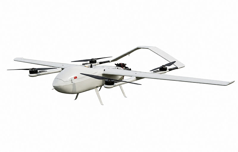
The industrial landscape for unmanned aerial vehicles (UAVs) has completely moved past the era of short-range, line-of-sight recreational piloting. Today, corporate enterprises, global logistics conglomerates, and agricultural operations rely on highly automated systems capable of traveling immense distances with absolute geometric precision. At the forefront of this industrial transformation is the VTOL drone. By seamlessly integrating the localized vertical takeoff agility of a multirotor with the extreme cruising range of a fixed-wing airplane, these hybrid platforms have become indispensable assets for large-scale operations. To truly capitalize on this hardware, organizations must understand how these advanced platforms operate within complex commercial environments—specifically their deployment in macro-level precision agriculture, middle-mile medical and cargo logistics, and the stringent engineering and regulatory parameters that dictate Beyond Visual Line of Sight (BVLOS) flight profiles.
Table of Contents
- 1. How are VTOL drones used in agriculture/delivery?
- 2. What is BVLOS flight in VTOL drones?
- 3. Operational Comparison Matrix: Agriculture vs. Cargo Logistics
- 4. Technical Architecture Behind Long-Range BVLOS Success
- 5. Risk Mitigation and Fail-Safe Frameworks for Enterprise Fleets
- 6. Frequently Asked Questions (FAQ)
How are VTOL drones used in agriculture/delivery?
Answer for Featured Snippet: In precision agriculture, VTOL drones are utilized to conduct macro-level crop scanning, using multi-spectral sensors to map thousands of hectares per flight to detect water stress, nitrogen deficiencies, and pest outbreaks. In delivery and cargo logistics, they act as middle-mile autonomous transport vehicles, moving high-value medical supplies, emergency items, or consumer parcels over distances of 50–100+ km without relying on ground transportation networks or runways.
Transforming Precision Agriculture and Macro-Forestry Management
The application of hybrid aircraft within the agricultural sector represents a massive technological shift from localized plant maintenance to wide-area macro analytics. While traditional multirotor platforms are highly efficient at targeted chemical spraying over limited acreage, their short battery lifespans make them completely impractical for analyzing massive industrial farms, sugar cane plantations, or vast forestry preserves. A hybrid aircraft solves this spatial limitation by utilizing aerodynamic wing lift to glide continuously at high velocities for multiple hours, allowing a single flight crew to capture data across thousands of hectares in one field shift.
During these extended agricultural flights, the aircraft carries specialized five-band or six-band multispectral sensor arrays. These industrial cameras capture data within highly specific light wavelengths—particularly the Near-Infrared (NIR) and Red Edge spectral zones. As healthy vegetation reflects high amounts of NIR light while stressed plants absorb it, the collected data can be compiled into highly detailed Normalized Difference Vegetation Index (NDVI) models. These maps give agronomists the power to pinpoint exact zones of crop stress, moisture deficiencies, or localized insect infestations up to ten days before the structural damage becomes visible to a physical ground scouting team. This allows farm managers to target localized fertilization and irrigation, optimizing resource efficiency and protecting regional soil chemistry from excessive chemical saturation.
Revolutionizing Middle-Mile Logistics and Urgent Medical Transport
In global supply chain management, the “middle-mile” and “last-mile” transport segments represent significant financial bottlenecks and logistical vulnerabilities. Ground transport vehicles face continuous delays from urban traffic congestion, poor road infrastructure, or impassable geographic barriers like rivers and mountain ranges. Heavy-lift hybrid delivery drones bypass these physical obstacles entirely by establishing direct, autonomous aerial corridors between regional distribution centers and remote destination drop points.
The real-world value of this aerial alternative is most apparent in urgent medical logistics networks. Humanitarian organizations and regional health authorities rely heavily on hybrid logistics aircraft to transport highly temperature-sensitive cargo—such as fresh blood bags, life-saving anti-venoms, critical vaccines, and emergency automated external defibrillators (AEDs)—directly to rural medical outposts. These advanced logistics drones feature active, climate-controlled internal payload bays that maintain exact refrigeration parameters throughout the flight. The aircraft lifts off vertically from a city medical facility, transitions to high-speed fixed-wing flight to travel 80 kilometers over rugged mountains, and executes an incredibly precise vertical touchdown in a distant clinic courtyard. This approach delivers critical care in minutes rather than the hours required for a rugged cross-country ambulance run.
What is BVLOS flight in VTOL drones?
Answer for Featured Snippet: BVLOS (Beyond Visual Line of Sight) flight in VTOL drones refers to operations where the aircraft flies past the direct physical vision of the pilot or visual observers. BVLOS flights rely entirely on advanced automated navigation systems, real-time telemetry streaming (via 4G LTE/5G or Satellite communications), and sophisticated DAAA (Detect and Avoid) technology like radar and ADSB-In to safely integrate the drone into shared airspace miles away from the operator.
To fully unlock the commercial potential of a hybrid fixed-wing aircraft, operations must expand past the limitations of Visual Line of Sight (VLOS) constraints. Under standard VLOS parameters, a pilot must keep the aircraft within their direct, un-aided physical vision at all times, which practically caps the drone’s operational radius to less than 1.5 to 2 kilometers. This visual bottleneck completely neutralizes the long-range engineering benefits of a hybrid airframe. True operational efficiency is achieved through Beyond Visual Line of Sight (BVLOS) flight profiles, allowing the aircraft to travel tens or hundreds of kilometers away from the operator to maximize data harvest and transport efficiency.
Executing a safe, regulator-approved BVLOS mission requires replacing human eyesight with an integrated suite of advanced aerospace sensors and robust data communication links. Because the remote pilot cannot visually monitor the airspace around the drone, the aircraft carries sophisticated **Detect and Avoid (DAA)** or **Sense and Avoid (SAA)** systems. These systems utilize a combination of active forward-facing millimeter-wave radar units, optical binocular computer-vision arrays, and ADSB-In (Automatic Dependent Surveillance-Broadcast) transceivers. By continuously scanning the surrounding sky, the onboard flight computer tracks the trajectory of nearby cooperative and non-cooperative aircraft, automatically adjusting its flight path to maintain safe separation distances without needing direct human intervention from the ground control station.
From a regulatory standpoint, securing a BVLOS operational permit from national civil aviation agencies (such as the FAA in the United States or EASA in Europe) requires demonstrating rigorous safety and risk management protocols. Organizations must prove that their hybrid aircraft features deep component redundancy, highly secure data encryption, and robust automated emergency fail-safe behaviors. Operating BVLOS changes the drone from a simple remotely piloted vehicle into a fully autonomous, industrial-grade aerospace asset that integrates seamlessly into the shared global airspace.
Operational Comparison Matrix: Agriculture vs. Cargo Logistics
To provide enterprise decision-makers and fleet managers with clear insights into how hybrid aircraft are configured across different commercial sectors, the table below breaks down the technical and operational variations between agricultural and delivery flight profiles.
| Operational Metric | Precision Agriculture Workflows | Cargo Delivery & Logistics Workflows |
|---|---|---|
| Primary Payload Integration | Multispectral / Hyperspectral Sensors, RGB Cameras | Climate-Controlled Insulated Cargo Compartments |
| Typical Payload Weight Class | Lightweight to Medium (1.0 – 3.5 kg) | Heavy-Duty Industrial (5.0 – 35.0+ kg) |
| Average Cruising Altitude | Low to Medium (100 – 150 meters AGL) | High Cruising Altitude (300 – 1000+ meters AGL) |
| Data Link Requirements | Localized RF Telemetry & RTK/PPK Corrections | Redundant 4G LTE / 5G / Satellite Communications |
| Primary Regulatory Focus | Low-altitude airspace clearance, land-owner permits | BVLOS certification, urban airspace integration, airworthiness |
| Flight Path Profile | Highly structured, back-and-forth grid lawnmower patterns | Direct, linear point-to-point transit corridors |
Technical Architecture Behind Long-Range BVLOS Success
The ability of a hybrid aircraft to fly reliably across a mountain range or along an oil pipeline corridor depends on a complex ecosystem of interconnected electronic and software systems. When evaluating an industrial platform for BVLOS readiness, three core technical frameworks must be analyzed.
1. Tri-Redundant Communications and Data Link Architecture
A true BVLOS platform cannot rely on a single radio frequency link, which can be easily disrupted by terrain, structural interference, or localized jamming. Enterprise hybrid platforms incorporate a tri-redundant communication system that shifts data streams seamlessly based on signal strength. For close-range launch and landing operations, a localized, encrypted digital radio frequency (RF) link handles command and telemetry data. Once the drone passes the horizon, primary command links automatically route through commercial 4G LTE and 5G cellular tracking networks. If the aircraft enters a remote region with zero cellular tower coverage, the autopilot instantly routes high-priority control data through global satellite constellations (SatCom), ensuring the ground station maintains continuous, real-time tracking control regardless of geographic isolation.
2. High-Precision IMU and GNSS Multi-Frequency Sensors
When a drone is flying miles away from its operator, its internal navigation systems must be completely bulletproof. BVLOS hybrid aircraft carry dual or triple Inertial Measurement Units (IMUs) alongside multiple high-performance GNSS receivers. These sensors work in tandem to continuously measure the aircraft’s exact pitch, roll, yaw, airspeed, and spatial coordinates. By running advanced Kalman filtering algorithms, the onboard flight computer filters out minor sensor errors. If a primary GPS receiver experiences a sudden signal drop or intentional RF spoofing, the backup IMU arrays and secondary positioning systems take over instantly, keeping the aircraft stable and on course along its pre-planned flight line.
3. Remote Airspace Deconfliction via UTM Systems
As commercial drone fleets expand, managing traffic within low-altitude airspace becomes critical. BVLOS aircraft integrate directly with cloud-based **Unmanned Traffic Management (UTM)** platforms. The UTM network acts as an automated air traffic control system for drones, tracking real-time flight telemetry from multiple operators simultaneously. Before a hybrid aircraft launches, its flight plan is uploaded to the UTM database to check for conflicts with other drone flights or restricted military zones. Mid-flight, the system receives real-time hazard alerts—such as incoming medical helicopters—and pushes automated path updates directly to the drone’s autopilot, ensuring safe, reliable deconfliction within the shared airspace.
Risk Mitigation and Fail-Safe Frameworks for Enterprise Fleets
Industrial drone management requires preparing thoroughly for worst-case scenarios. Because a hybrid aircraft represents a significant capital investment and operates in shared civil airspace, manufacturers design layered, autonomous fail-safe systems to safely mitigate unexpected hardware or environmental failures.
1. Dynamic Return-to-Home (RTH) Protocols
If the primary tracking data link disconnects completely and stays down past a pre-configured safety window (e.g., 30 seconds), the onboard flight controller triggers its autonomous Return-to-Home protocol. The drone does not simply fly back blindly in a straight line. The autopilot evaluates the aircraft’s current fuel or battery levels, assesses real-time wind speeds, avoids known terrain obstacles using its internal 3D database, and navigates back to its home base. Once it arrives over the launch site, it engages its vertical thrusters and executes a soft, autonomous pinpoint touchdown.
2. Mid-Air Motor Stall and Aerodynamic Contingencies
One of the key engineering benefits of a hybrid design is its built-in mechanical redundancy. If the main forward cruise motor fails or drops power mid-flight, the drone does not drop out of the sky. The onboard flight computer instantly recognizes the loss of forward airspeed, aborts the fixed-wing cruise profile, and fires up its high-torque vertical multirotor lift thrusters. The drone converts immediately back into a multirotor, allowing it to maintain altitude, hover stably, and perform an immediate vertical emergency landing right beneath its current position.
3. Emergency Ballistic Parachute Systems
For operations over sensitive infrastructure or critical industrial facilities, regulators often require a final line of safety defense: an integrated ballistic parachute system. If the aircraft suffers a catastrophic total power loss that disables both the forward cruise motor and the vertical lift thrusters, the onboard safety computer deploys a ballistic parachute using a pressurized gas canister. The canopy deploys fully within fractions of a second, slowing the aircraft’s descent to a harmless speed. This protect your high-value camera payloads and ensures that if a critical failure occurs, the airframe poses zero physical danger to people or property on the ground.
Frequently Asked Questions (FAQ)
Q1: Can an agricultural VTOL drone also be used to spray liquid fertilizers?
While some specialized large-scale heavy-lift hybrid platforms are designed to carry liquid spray tanks, the vast majority of commercial agricultural hybrid platforms are optimized for long-range mapping and multispectral analysis. Liquid spraying requires significant lifting capacity and frequent landing cycles, which is best handled by large, dedicated multirotor spraying platforms. Using a hybrid aircraft for wide-area crop health analysis allows you to pinpoint exact problem areas, creating targeted spray maps that make your multirotor spraying operations far more efficient.
Q2: What is the difference between BVLOS and EVLOS flight profiles?
In a true BVLOS (Beyond Visual Line of Sight) mission, the remote pilot cannot see the aircraft at all, relying entirely on telemetry data and onboard sensors to manage the flight. In an EVLOS (Extended Visual Line of Sight) mission, the primary pilot still cannot see the drone, but the team places trained human “visual observers” along the flight path. These observers maintain continuous physical sight of the drone and communicate with the pilot via two-way radios, providing a simpler regulatory approval path for intermediate-range missions.
Q3: How do delivery VTOL drones drop off their cargo at the destination?
Depending on the specific airframe design and landing site safety requirements, hybrid cargo drones use two main delivery methods. The most common method is a full autonomous touchdown: the drone lands vertically on a designated 3×3 meter pad, automatically unlocks its cargo bay latch to release the package, and takes off again immediately. For tight spaces or un-prepared ground sites, advanced delivery systems use a motorized internal winch system, hovering safely at an altitude of 15 meters while lowering the package down smoothly on a high-tensile cable.
Q4: Are commercial BVLOS flights permitted to cross international borders?
Crossing international borders during a BVLOS flight requires securing explicit operational authorizations and airspace waivers from the civil aviation authorities of both countries simultaneously. The drone’s flight management system must integrate with both regional air traffic control networks, and the communication architecture must support seamless handovers between different regional cellular and satellite networks. This cross-border capability is increasingly common in international medical logistics and cross-country infrastructure management.


