
Subtotal: 240.00$
Sale!
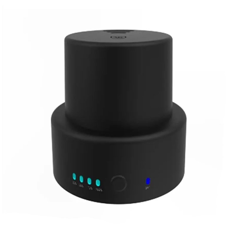
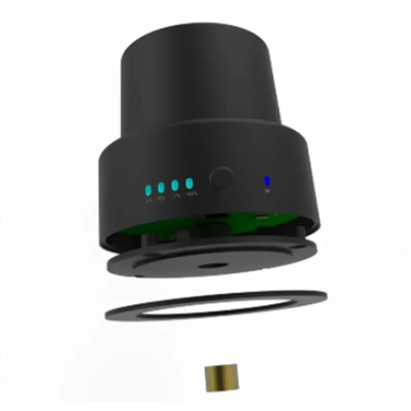
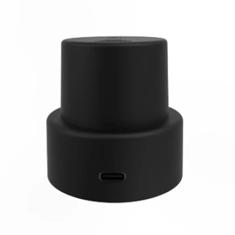
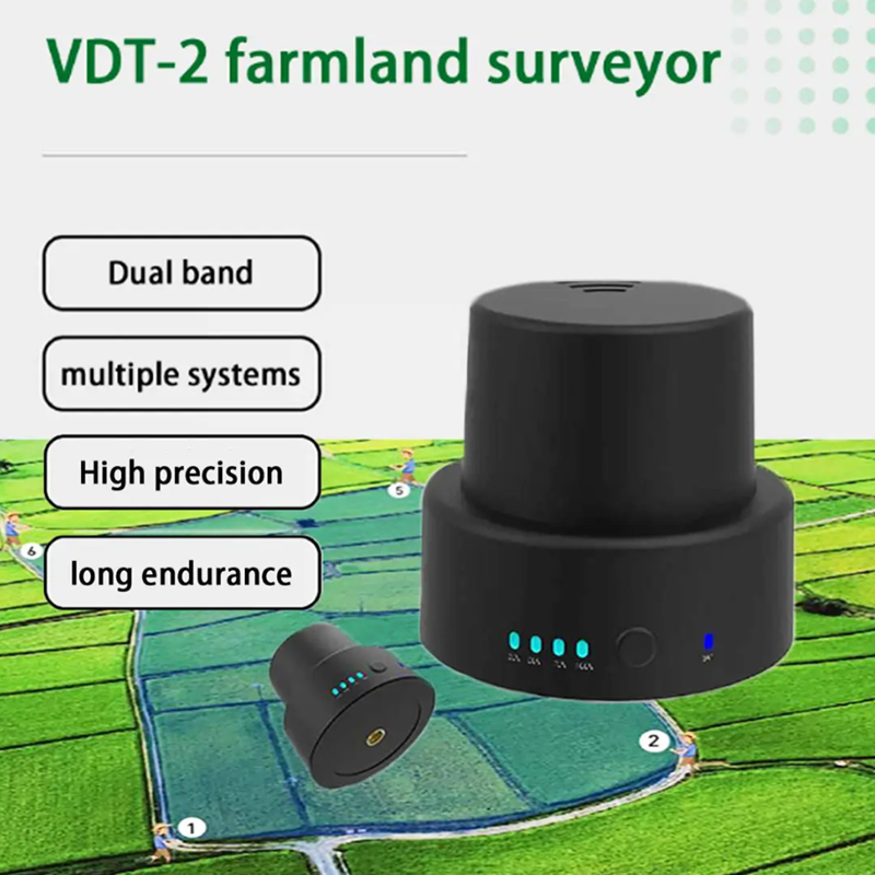
VK VDT-2 Dotting Device Agriculture Farmland Surveyor Dual Frequency Multi-system High Precision
Original price was: 199.00$.194.00$Current price is: 194.00$.
VK VDT-2 lightweight perception mapping module with dual-frequency multi-system GNSS, centimeter RTK positioning, IP67 waterproof, 65g ultra-light body. Support handheld farm boundary survey & seamless docking with VK industrial flight controller V10-PRO for agricultural spraying, aerial mapping, low-altitude obstacle perception & autonomous UAV navigation. Bluetooth wireless data transmission, 6h long endurance.
Product Description
Product Overview – VDT-2 UAV Perception Mapping Module
The VK-FLY VDT-2 is a lightweight integrated environmental perception and centimeter-level GNSS mapping module independently developed by VK-FLY (Weike UAV Tech). Designed for agricultural plant protection drones, survey mapping UAVs, low-altitude inspection drones and handheld field survey work, it combines multi-constellation dual-frequency RTK positioning, real-time terrain perception, obstacle distance sensing and wireless data transmission in one compact unit.
Compatible natively with VK-FLY V10-PRO industrial flight controller via CAN bus serial protocol, VDT-2 delivers real-time terrain elevation data, farm boundary coordinate collection and auxiliary obstacle perception to realize fully autonomous low-altitude flight, automatic terrain follow and intelligent route planning for UAV operations.
Weighing only 65g with IP67 dustproof & waterproof grade, the module works stably in rain, fog, dust and strong light farmland environments, solving positioning drift and perception failure pain points of single GPS sensors in complex orchard, mountain and power line corridors.
Core Advantages of VDT-2 Perception Module
- Dual-Frequency Multi-Constellation GNSS RTK, Centimeter Precision
Supports BeiDou, GPS, GLONASS, Galileo, QZSS multi-satellite systems; standalone positioning accuracy 1.5m, RTK differential accuracy up to 2cm, fast cold start within 30 seconds.
- Ultra-Light Miniature Integration, Low Load for Drones
Total weight only 65g, small footprint, no extra burden for multi-rotor and VTOL UAV platforms; easy installation on drone frame or telescopic survey rod for handheld mapping.
- All-Weather IP67 Waterproof & Dustproof
Sealed industrial enclosure, resistant to farm chemical splashes, heavy rain and field dust, suitable for long-time outdoor continuous operation.
- Bluetooth BLE 4.0 Wireless Data Link
Real-time coordinate transmission to ground station, mobile APP and VK flight control system; one-click cloud upload of survey boundary data without wired connection.
- Native Compatibility with VK-FLY Industrial Flight Control
Plug-and-play matching with V10-PRO autopilot; real-time perception data output for terrain follow, obstacle early warning and automatic spray area planning.
- 6 Hours Long Continuous Battery Life
Built-in rechargeable lithium battery, Type-C fast charging interface, supports all-day field survey missions without frequent power replacement.
- Multi-Scenario Perception Function Fusion
Integrates ground altitude perception, farm boundary coordinate capture, low-altitude obstacle ranging three core functions, replace separate GNSS + radar dual-sensor combination to reduce drone wiring complexity.
Technical Specifications
| Parameter | Detailed Spec |
|---|---|
| Model | VDT-2 Perception Mapping Module |
| Total Weight | 65g |
| GNSS Signal Bands | BDS B1I/B1C/B2a; GPS L1/L5; GLONASS L1; Galileo E1/E5a |
| Positioning Accuracy | Standalone: 1.5m; RTK Differential: ≤2cm |
| Cold Start Time | ≤30s |
| Communication | Bluetooth BLE4.0 + SPP2.0, CAN serial for drone flight control |
| Protection Grade | IP67 Waterproof & Dustproof |
| Battery Endurance | Up to 6 hours continuous work |
| Charging Interface | Type-C USB |
| Compatible Flight Controller | VK-FLY V10-PRO Industrial Autopilot |
| Working Temperature | -20℃ ~ +60℃ |
| Core Functions | Farm boundary survey, terrain perception, low-altitude obstacle auxiliary ranging, UAV RTK positioning data output |
Main Application Scenarios
- Precision Agriculture Plant Protection Drones
Collect orchard/farm field boundaries, automatic variable spraying, terrain follow flight
- Aerial Survey & Mapping UAVs
Handheld field boundary measurement, pre-flight survey data acquisition for mapping missions
- Power Line & Pipeline Inspection Drones
Low-altitude terrain perception to avoid towers, wires and mountain obstacles
- VTOL Heavy-Lift Cargo UAVs
Auxiliary high-precision positioning for automatic takeoff & landing
- Handheld Land Survey Equipment
Agricultural land right confirmation, field area calculation, farm plot mapping
- Emergency Rescue & Public Security UAVs
Complex terrain positioning and environmental perception in mountain, forest and flood zones
Compatibility Matching Solution
- Drone Mount Mode
Directly connect to VK-FLY V10-PRO flight controller via CAN-HUB port; perception & RTK positioning data automatically synced to ground control station to trigger terrain follow and obstacle slowdown logic.
- Handheld Survey Mode
Install on telescopic measuring rod, pair with VK ground station APP via Bluetooth, walk along field edges to record real-time coordinates, auto-generate farm plots and export KML files for drone mission planning.
- Secondary Development Support
Open MAVLink data protocol, support system integration for UAV manufacturers and solution integrators.
FAQ
Q1: What flight controllers can the VDT-2 perception module match?
A: VDT-2 is fully plug-and-play compatible with VK-FLY V10-PRO industrial drone flight controller, also supports secondary development docking with other MAVLink standard autopilots.
A: VDT-2 is fully plug-and-play compatible with VK-FLY V10-PRO industrial drone flight controller, also supports secondary development docking with other MAVLink standard autopilots.
Q2: How accurate is the positioning of VDT-2?
A: Standalone single-point positioning reaches 1.5m; after connecting RTK base station, horizontal & vertical accuracy up to 2 centimeters, meeting high-standard agricultural survey and mapping demands.
A: Standalone single-point positioning reaches 1.5m; after connecting RTK base station, horizontal & vertical accuracy up to 2 centimeters, meeting high-standard agricultural survey and mapping demands.
Q3: Can VDT-2 work in rainy or dusty farmland?
A: Yes, it adopts IP67 industrial sealing structure, resistant to rain splash, pesticide liquid and field dust, stable operation under harsh outdoor conditions.
A: Yes, it adopts IP67 industrial sealing structure, resistant to rain splash, pesticide liquid and field dust, stable operation under harsh outdoor conditions.
Q4: Can VDT-2 be used both on drones and handheld for survey?
A: Dual-purpose design. It can be fixed on drone fuselage for real-time flight perception, or installed on a telescopic rod for manual field boundary measurement.
A: Dual-purpose design. It can be fixed on drone fuselage for real-time flight perception, or installed on a telescopic rod for manual field boundary measurement.
Q5: What is the continuous working time of VDT-2?
A: Built-in high-capacity lithium battery supports up to 6 hours non-stop survey work, with Type-C fast charging for quick power replenishment.
A: Built-in high-capacity lithium battery supports up to 6 hours non-stop survey work, with Type-C fast charging for quick power replenishment.
Be the first to review “VK VDT-2 Dotting Device Agriculture Farmland Surveyor Dual Frequency Multi-system High Precision”
Related Products
Reviews
There are no reviews yet.